Taoyang geodata
Taoyang (Gansu) is a seat of a third-order administrative division; located in China in Asia/Shanghai (GMT+8) time zone. In our database, there are 1268 cities with bigger population. Compared to other cities in China, 75.8% of cities are located further ↓South; 90.5% of cities are located further →East and 94% of cities have lower elevation than Taoyang. Note1


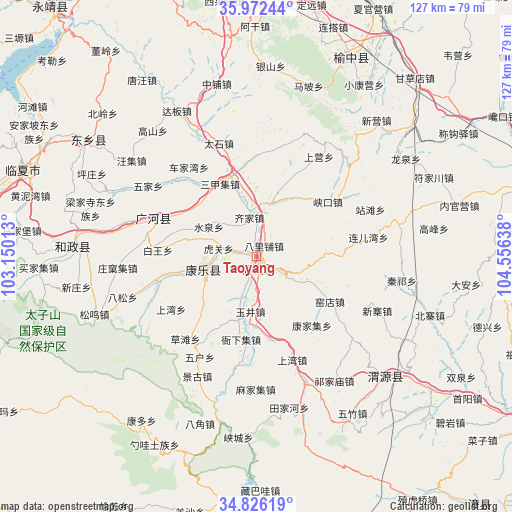
Taoyang GPS coordinates[2]
35° 24' 4.86" North, 103° 51' 11.7" East
| Map corner | latitude | longitude |
|---|---|---|
| Upper-left | 35.97244°, | 103.15013° |
| Center: | 35.40135°, | 103.85325° |
| Lower-right: | 34.82619°, | 104.55638° |
| Map W x H: | 127.5×127.5 km | = 79.2×79.2mi |
| max Lat: | 53.31946° ⇑24.2% North |
| Taoyang: | 35.40135° |
| min Lat: | ⇓75.8% South 18.22056° |
| min Long | Taoyang | max Long |
| 75.07348° | 103.85325° | 134.28917° |
| W 9.5%⇐ | ⇒90.5% E |
Elevation
Elevation of Taoyang is 1870 m = 6135 ft, and this is 1385.2 m = 4545 ft above average elevation for this country.
| Max E: |
5622 m = 18445 ft | 6% |
| Taoyang | 1870 m 6135 ft | |
| Avg. | 484.8 m = 1591 ft | |
Min E: |
-3 m = -10 ft | 94% |
See also: China elevation on elevation.city.
Geographical zone
Taoyang is located in North temperate zone (between Tropic of Cancer and the Arctic Circle). Distance of this Northern Tropic circle is 1330.3 km =826.6 mi to South.| Distance of | km | miles | from Taoyang |
|---|---|---|---|
| North Pole | 6070.8 | 3772.2 | to North |
| Arctic Circle | 3464.9 | 2153 | to North |
| Tropic Cancer | 1330.3 | 826.6 | to South |
| Equator | 3936.3 | 2445.9 | to South |


Nearby cities:
15 places around Taoyang: (largest is in red/bold)
• Bajiao
43.8 km =27.2 mi,  198°
198°
• Fucheng
13.8 km =8.6 mi,  256°
256°
• Guanghe Chengguanzhen
26.6 km =16.5 mi,  289°
289°
• Hezheng Chengguanzhen
45.1 km =28 mi,  274°
274°
• Kangduo
50.6 km =31.4 mi,  216°
216°
• Lianlu
44.1 km =27.4 mi,  192°
192°
• Qingyuan
44.6 km =27.7 mi,  131°
131°
• Shaowa
54 km =33.6 mi,  209°
209°
• Suonan
50.7 km =31.5 mi,  305°
305°
• Tianjiahe
38.6 km =24 mi,  168°
168°
• Xiacheng
45.3 km =28.1 mi, 185°
• Yangzhuang
40.8 km =25.4 mi,  155°
155°
• Yeliguan
51.6 km =32.1 mi, 199°
• Yuzhong Chengguanzhen
54.4 km =33.8 mi,  25°
25°
• Zangbawa
58.3 km =36.2 mi,  179°
179°
Sources, notices
• [Note1] Compared only with cities in China existing in our database
• [Src1] Map data: © OpenStreetMap contributors (CC-BY-SA)
• [Src2] Other city data from geonames.org with taken over terms of usage.
• [Src3] Geographical zone / Annual Mean Temperature by Robert A. Rohde @ Wikipedia
