Tange Zhen geodata
Tange Zhen (Gansu) is a seat of a fourth-order administrative division; located in China in Asia/Shanghai (GMT+8) time zone. In our database, there are 1268 cities with bigger population. Compared to other cities in China, 73.4% of cities are located further ↓South; 89.2% of cities are located further →East and 93.4% of cities have lower elevation than Tange Zhen. Note1


Tange Zhen GPS coordinates[2]
34° 37' 39.504" North, 104° 50' 26.232" East
| Map corner | latitude | longitude |
|---|---|---|
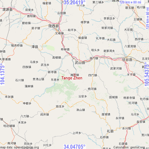
| Upper-left | 35.20419°, | 104.1375° |
| Center: | 34.62764°, | 104.84062° |
| Lower-right: | 34.04705°, | 105.54375° |
| Map W x H: | 128.7×128.7 km | = 80×80mi |
| max Lat: | 53.31946° ⇑26.6% North |
| Tange Zhen: | 34.62764° |
| min Lat: | ⇓73.4% South 18.22056° |
| min Long | Tange Zhen | max Long |
| 75.07348° | 104.84062° | 134.28917° |
| W 10.8%⇐ | ⇒89.2% E |
Elevation
Elevation of Tange Zhen is 1767 m = 5797 ft, and this is 1282.2 m = 4207 ft above average elevation for this country.
| Max E: |
5622 m = 18445 ft | 6.6% |
| Tange Zhen | 1767 m 5797 ft | |
| Avg. | 484.8 m = 1591 ft | |
Min E: |
-3 m = -10 ft | 93.4% |
See also: China elevation on elevation.city.
Geographical zone
Tange Zhen is located in North temperate zone (between Tropic of Cancer and the Arctic Circle). Distance of this Northern Tropic circle is 1244.3 km =773.2 mi to South.| Distance of | km | miles | from Tange Zhen |
|---|---|---|---|
| North Pole | 6156.8 | 3825.7 | to North |
| Arctic Circle | 3550.9 | 2206.4 | to North |
| Tropic Cancer | 1244.3 | 773.2 | to South |
| Equator | 3850.2 | 2392.4 | to South |


Nearby cities:
15 places around Tange Zhen: (largest is in red/bold)
• Caizi Zhen
52.4 km =32.6 mi,  319°
319°
• Gangu Chengguanzhen
46 km =28.6 mi,  74°
74°
• Gongchang Zhen
45.2 km =28.1 mi,  336°
336°
• Jiangkou
67.6 km =42 mi,  159°
159°
• Lichuan Zhen
63.7 km =39.6 mi,  228°
228°
• Lujing Zhen
43 km =26.7 mi,  217°
217°
• Mawu
23.4 km =14.5 mi, 163°
• Santai Zhen
37.3 km =23.2 mi, 343°
• Taijing
65.2 km =40.5 mi,  96°
96°
• Wenfeng Zhen
38.3 km =23.8 mi, 340°
• Wulong
63.8 km =39.6 mi,  77°
77°
• Xinghua
65.3 km =40.6 mi,  201°
201°
• Xinsi Zhen
19.4 km =12.1 mi,  277°
277°
• Yuanyang Zhen
18.8 km =11.7 mi, 341°
• Zhongba
68.2 km =42.4 mi,  165°
165°
Sources, notices
• [Note1] Compared only with cities in China existing in our database
• [Src1] Map data: © OpenStreetMap contributors (CC-BY-SA)
• [Src2] Other city data from geonames.org with taken over terms of usage.
• [Src3] Geographical zone / Annual Mean Temperature by Robert A. Rohde @ Wikipedia
