Caizi Zhen geodata
Caizi Zhen (Gansu) is a seat of a fourth-order administrative division; located in China in Asia/Shanghai (GMT+8) time zone. In our database, there are 1268 cities with bigger population. Compared to other cities in China, 75% of cities are located further ↓South; 89.7% of cities are located further →East and 94.5% of cities have lower elevation than Caizi Zhen. Note1


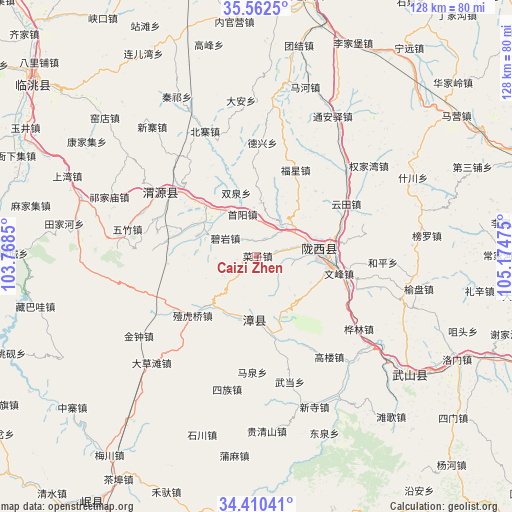
Caizi Zhen GPS coordinates[2]
34° 59' 18.528" North, 104° 28' 17.832" East
| Map corner | latitude | longitude |
|---|---|---|
| Upper-left | 35.5625°, | 103.7685° |
| Center: | 34.98848°, | 104.47162° |
| Lower-right: | 34.41041°, | 105.17475° |
| Map W x H: | 128.1×128.1 km | = 79.6×79.6mi |
| max Lat: | 53.31946° ⇑25% North |
| Caizi Zhen: | 34.98848° |
| min Lat: | ⇓75% South 18.22056° |
| min Long | Caizi Zhen | max Long |
| 75.07348° | 104.47162° | 134.28917° |
| W 10.3%⇐ | ⇒89.7% E |
Elevation
Elevation of Caizi Zhen is 1942 m = 6371 ft, and this is 1457.2 m = 4781 ft above average elevation for this country.
| Max E: |
5622 m = 18445 ft | 5.5% |
| Caizi Zhen | 1942 m 6371 ft | |
| Avg. | 484.8 m = 1591 ft | |
Min E: |
-3 m = -10 ft | 94.5% |
See also: China elevation on elevation.city.
Geographical zone
Caizi Zhen is located in North temperate zone (between Tropic of Cancer and the Arctic Circle). Distance of this Northern Tropic circle is 1284.4 km =798.1 mi to South.| Distance of | km | miles | from Caizi Zhen |
|---|---|---|---|
| North Pole | 6116.7 | 3800.7 | to North |
| Arctic Circle | 3510.8 | 2181.5 | to North |
| Tropic Cancer | 1284.4 | 798.1 | to South |
| Equator | 3890.4 | 2417.4 | to South |


Nearby cities:
15 places around Caizi Zhen: (largest is in red/bold)
• Bailin
54.6 km =33.9 mi,  242°
242°
• Gongchang Zhen
15.4 km =9.6 mi,  85°
85°
• Maying
61.1 km =38 mi,  54°
54°
• Qingyuan
28.1 km =17.5 mi,  305°
305°
• Santai Zhen
23.6 km =14.7 mi,  100°
100°
• Tange Zhen
52.4 km =32.6 mi,  139°
139°
• Tianjiahe
49 km =30.4 mi,  279°
279°
• Wenfeng Zhen
21 km =13 mi, 101°
• Xiacheng
60.9 km =37.8 mi,  270°
270°
• Xiaozhai
57.1 km =35.5 mi,  227°
227°
• Xinsi Zhen
40.4 km =25.1 mi,  159°
159°
• Yangzhuang
40.3 km =25 mi, 282°
• Yuanyang Zhen
35.6 km =22.1 mi,  128°
128°
• Zangbawa
57 km =35.4 mi,  257°
257°
• Zhongzhai
59.7 km =37.1 mi, 230°
Sources, notices
• [Note1] Compared only with cities in China existing in our database
• [Src1] Map data: © OpenStreetMap contributors (CC-BY-SA)
• [Src2] Other city data from geonames.org with taken over terms of usage.
• [Src3] Geographical zone / Annual Mean Temperature by Robert A. Rohde @ Wikipedia
