Jiangchang geodata
Jiangchang (Hubei) is a seat of a fourth-order administrative division; located in China in Asia/Shanghai (GMT+8) time zone. In our database, there are 1268 cities with bigger population. Compared to other cities in China, 51.3% of cities are located further ↓South; 57.9% of cities are located further →East and 78.3% of cities have higher elevation than Jiangchang. Note1


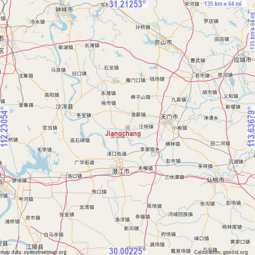
Jiangchang GPS coordinates[2]
30° 36' 33.408" North, 112° 56' 1.176" East
| Map corner | latitude | longitude |
|---|---|---|
| Upper-left | 31.21253°, | 112.23054° |
| Center: | 30.60928°, | 112.93366° |
| Lower-right: | 30.00225°, | 113.63679° |
| Map W x H: | 134.6×134.6 km | = 83.6×83.6mi |
| max Lat: | 53.31946° ⇑48.7% North |
| Jiangchang: | 30.60928° |
| min Lat: | ⇓51.3% South 18.22056° |
| min Long | Jiangchang | max Long |
| 75.07348° | 112.93366° | 134.28917° |
| W 42.1%⇐ | ⇒57.9% E |
Elevation
Elevation of Jiangchang is 30 m = 98 ft, and this is 454.8 m = 1492 ft below average elevation for this country.
| Max E: |
5622 m = 18445 ft | 78.3% |
| Avg. | 484.8 m = 1591 ft | |
| Jiangchang | 30 m = 98 ft | |
Min E: |
-3 m = -10 ft | 21.7% |
See also: China elevation on elevation.city.
Geographical zone
Jiangchang is located in North temperate zone (between Tropic of Cancer and the Arctic Circle). Distance of this Northern Tropic circle is 797.5 km =495.5 mi to South.| Distance of | km | miles | from Jiangchang |
|---|---|---|---|
| North Pole | 6603.6 | 4103.3 | to North |
| Arctic Circle | 3997.7 | 2484.1 | to North |
| Tropic Cancer | 797.5 | 495.5 | to South |
| Equator | 3403.4 | 2114.8 | to South |


Nearby cities:
15 places around Jiangchang: (largest is in red/bold)
• Fozishan
17.5 km =10.9 mi,  21°
21°
• Houkou
19.8 km =12.3 mi,  84°
84°
• Huangtan
15.6 km =9.7 mi,  68°
68°
• Jingling
16.5 km =10.3 mi, 74°
• Lijiazui
16.2 km =10.1 mi,  134°
134°
• Qianjiang
21.3 km =13.2 mi,  190°
190°
• Shihe
21.7 km =13.5 mi,  40°
40°
• Tuoshi
16.7 km =10.4 mi,  322°
322°
• Wangchang
9.6 km =6 mi,  85°
85°
• Wangchang
19.5 km =12.1 mi,  234°
234°
• Yuxin
9 km =5.6 mi, 37°
• Zekou
14.8 km =9.2 mi,  203°
203°
• Zhanggang
6.8 km =4.2 mi, 232°
• Zhengchang
15.8 km =9.8 mi,  145°
145°
• Zhugentan
12.8 km =8 mi, 193°
Sources, notices
• [Note1] Compared only with cities in China existing in our database
• [Src1] Map data: © OpenStreetMap contributors (CC-BY-SA)
• [Src2] Other city data from geonames.org with taken over terms of usage.
• [Src3] Geographical zone / Annual Mean Temperature by Robert A. Rohde @ Wikipedia
