Wanjia geodata
Wanjia (Anhui) is a seat of a fourth-order administrative division; located in China in Asia/Shanghai (GMT+8) time zone. In our database, there are 1268 cities with bigger population. Compared to other cities in China, 50.4% of cities are located further ↑North; 76.7% of cities are located further ←West and 56.7% of cities have lower elevation than Wanjia. Note1


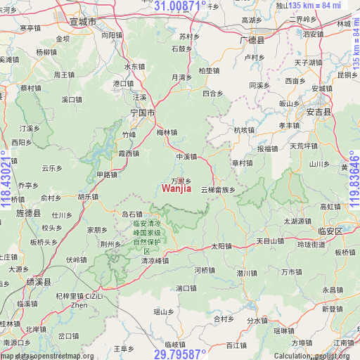
Wanjia GPS coordinates[2]
30° 24' 15.012" North, 119° 7' 59.988" East
| Map corner | latitude | longitude |
|---|---|---|
| Upper-left | 31.00871°, | 118.43021° |
| Center: | 30.40417°, | 119.13333° |
| Lower-right: | 29.79587°, | 119.83646° |
| Map W x H: | 134.9×134.9 km | = 83.8×83.8mi |
| max Lat: | 53.31946° ⇑50.4% North |
| Wanjia: | 30.40417° |
| min Lat: | ⇓49.6% South 18.22056° |
| min Long | Wanjia | max Long |
| 75.07348° | 119.13333° | 134.28917° |
| W 76.7%⇐ | ⇒23.3% E |
Elevation
Elevation of Wanjia is 223 m = 732 ft, and this is 261.8 m = 859 ft below average elevation for this country.
| Max E: |
5622 m = 18445 ft | 43.3% |
| Avg. | 484.8 m = 1591 ft | |
| Wanjia | 223 m = 732 ft | |
Min E: |
-3 m = -10 ft | 56.7% |
See also: China elevation on elevation.city.
Geographical zone
Wanjia is located in North temperate zone (between Tropic of Cancer and the Arctic Circle). Distance of this Northern Tropic circle is 774.7 km =481.4 mi to South.| Distance of | km | miles | from Wanjia |
|---|---|---|---|
| North Pole | 6626.4 | 4117.5 | to North |
| Arctic Circle | 4020.5 | 2498.2 | to North |
| Tropic Cancer | 774.7 | 481.4 | to South |
| Equator | 3380.6 | 2100.6 | to South |


Nearby cities:
15 places around Wanjia: (largest is in red/bold)
• Daoshi
21.7 km =13.5 mi,  234°
234°
• Henglu
20.3 km =12.6 mi,  121°
121°
• Honglong
16.2 km =10.1 mi,  310°
310°
• Longgang
26.9 km =16.7 mi,  182°
182°
• Meilin
18.8 km =11.7 mi,  344°
344°
• Ningdun
6.5 km =4 mi, 338°
• Xiaxi
21.9 km =13.6 mi,  299°
299°
• Xinqiao
25.8 km =16 mi, 228°
• Yejia
14.8 km =9.2 mi,  88°
88°
• Yunti
14.7 km =9.1 mi,  103°
103°
• Yutiao
16.6 km =10.3 mi,  219°
219°
• Zhangcun
24.1 km =15 mi,  73°
73°
• Zhongxi
9.5 km =5.9 mi,  14°
14°
• Zhufeng
26.2 km =16.3 mi, 314°
• Zhujiaqiao
6.3 km =3.9 mi,  264°
264°
Sources, notices
• [Note1] Compared only with cities in China existing in our database
• [Src1] Map data: © OpenStreetMap contributors (CC-BY-SA)
• [Src2] Other city data from geonames.org with taken over terms of usage.
• [Src3] Geographical zone / Annual Mean Temperature by Robert A. Rohde @ Wikipedia
