Yuquan geodata
Yuquan (Hubei) is a seat of a fourth-order administrative division; located in China in Asia/Shanghai (GMT+8) time zone. In our database, there are 1268 cities with bigger population. Compared to other cities in China, 53.2% of cities are located further ↓South; 63.6% of cities are located further →East and 65.8% of cities have higher elevation than Yuquan. Note1


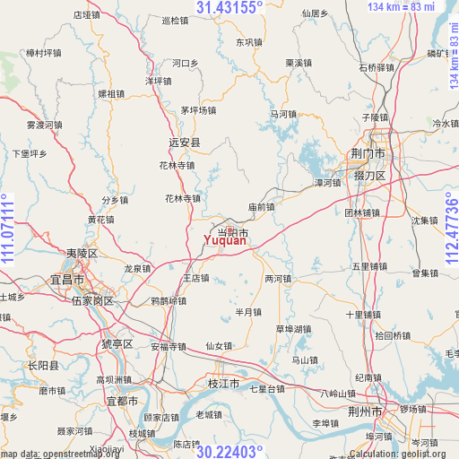
Yuquan GPS coordinates[2]
30° 49' 46.884" North, 111° 46' 27.228" East
| Map corner | latitude | longitude |
|---|---|---|
| Upper-left | 31.43155°, | 111.07111° |
| Center: | 30.82969°, | 111.77423° |
| Lower-right: | 30.22403°, | 112.47736° |
| Map W x H: | 134.3×134.3 km | = 83.5×83.5mi |
| max Lat: | 53.31946° ⇑46.8% North |
| Yuquan: | 30.82969° |
| min Lat: | ⇓53.2% South 18.22056° |
| min Long | Yuquan | max Long |
| 75.07348° | 111.77423° | 134.28917° |
| W 36.4%⇐ | ⇒63.6% E |
Elevation
Elevation of Yuquan is 69 m = 226 ft, and this is 415.8 m = 1364 ft below average elevation for this country.
| Max E: |
5622 m = 18445 ft | 65.8% |
| Avg. | 484.8 m = 1591 ft | |
| Yuquan | 69 m = 226 ft | |
Min E: |
-3 m = -10 ft | 34.2% |
See also: China elevation on elevation.city.
Geographical zone
Yuquan is located in North temperate zone (between Tropic of Cancer and the Arctic Circle). Distance of this Northern Tropic circle is 822 km =510.8 mi to South.| Distance of | km | miles | from Yuquan |
|---|---|---|---|
| North Pole | 6579.1 | 4088.1 | to North |
| Arctic Circle | 3973.2 | 2468.8 | to North |
| Tropic Cancer | 822 | 510.8 | to South |
| Equator | 3427.9 | 2130 | to South |


Nearby cities:
15 places around Yuquan: (largest is in red/bold)
• Baling
2.3 km =1.4 mi,  49°
49°
• Banyue
24.2 km =15 mi,  167°
167°
• Fenxiang
35.1 km =21.8 mi,  285°
285°
• Herong
23.4 km =14.5 mi,  125°
125°
• Hualinsi
24.9 km =15.5 mi,  321°
321°
• Jiuxian
36 km =22.4 mi,  333°
333°
• Lianghe
19.8 km =12.3 mi, 134°
• Longquan
29.3 km =18.2 mi,  247°
247°
• Miaoqian
11.5 km =7.1 mi, 53°
• Mingfeng
28.7 km =17.8 mi, 334°
• Wangdian
16.8 km =10.4 mi,  216°
216°
• Wen’an
34.3 km =21.3 mi, 172°
• Xiannü
33.8 km =21 mi,  185°
185°
• Yaqueling
27.3 km =17 mi, 221°
• Zhanghe
31.6 km =19.6 mi,  63°
63°
Sources, notices
• [Note1] Compared only with cities in China existing in our database
• [Src1] Map data: © OpenStreetMap contributors (CC-BY-SA)
• [Src2] Other city data from geonames.org with taken over terms of usage.
• [Src3] Geographical zone / Annual Mean Temperature by Robert A. Rohde @ Wikipedia
