Xiannü geodata
Xiannü (Hubei) is a seat of a fourth-order administrative division; located in China in Asia/Shanghai (GMT+8) time zone. In our database, there are 1268 cities with bigger population. Compared to other cities in China, 50.6% of cities are located further ↓South; 63.8% of cities are located further →East and 65.6% of cities have higher elevation than Xiannü. Note1


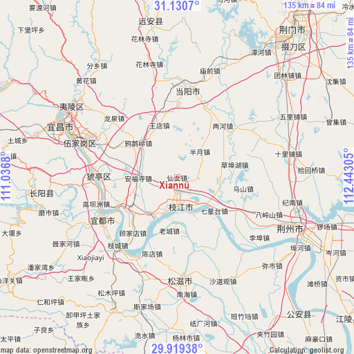
Xiannü GPS coordinates[2]
30° 31' 36.948" North, 111° 44' 23.712" East
| Map corner | latitude | longitude |
|---|---|---|
| Upper-left | 31.1307°, | 111.0368° |
| Center: | 30.52693°, | 111.73992° |
| Lower-right: | 29.91938°, | 112.44305° |
| Map W x H: | 134.7×134.7 km | = 83.7×83.7mi |
| max Lat: | 53.31946° ⇑49.4% North |
| Xiannü: | 30.52693° |
| min Lat: | ⇓50.6% South 18.22056° |
| min Long | Xiannü | max Long |
| 75.07348° | 111.73992° | 134.28917° |
| W 36.2%⇐ | ⇒63.8% E |
Elevation
Elevation of Xiannü is 70 m = 230 ft, and this is 414.8 m = 1361 ft below average elevation for this country.
| Max E: |
5622 m = 18445 ft | 65.6% |
| Avg. | 484.8 m = 1591 ft | |
| Xiannü | 70 m = 230 ft | |
Min E: |
-3 m = -10 ft | 34.4% |
See also: China elevation on elevation.city.
Geographical zone
Xiannü is located in North temperate zone (between Tropic of Cancer and the Arctic Circle). Distance of this Northern Tropic circle is 788.4 km =489.9 mi to South.| Distance of | km | miles | from Xiannü |
|---|---|---|---|
| North Pole | 6612.8 | 4109 | to North |
| Arctic Circle | 4006.9 | 2489.8 | to North |
| Tropic Cancer | 788.4 | 489.9 | to South |
| Equator | 3394.3 | 2109.1 | to South |


Nearby cities:
15 places around Xiannü: (largest is in red/bold)
• Anfusi
14.8 km =9.2 mi,  269°
269°
• Bailizhou
14.7 km =9.1 mi,  156°
156°
• Baiyang
25 km =15.5 mi,  242°
242°
• Banyue
13.1 km =8.1 mi,  40°
40°
• Dongshi
13.6 km =8.5 mi,  194°
194°
• Gujiadian
26.9 km =16.7 mi,  215°
215°
• Herong
29.9 km =18.6 mi,  48°
48°
• Laocheng
20.4 km =12.7 mi, 188°
• Lianghe
26.3 km =16.3 mi, 41°
• Qixingtai
18.9 km =11.7 mi,  131°
131°
• Wangdian
21.3 km =13.2 mi,  341°
341°
• Wen’an
7.9 km =4.9 mi,  92°
92°
• Yaqueling
19.8 km =12.3 mi,  311°
311°
• Yunchi
28.7 km =17.8 mi, 268°
• Zhijiang
11.8 km =7.3 mi,  173°
173°
Sources, notices
• [Note1] Compared only with cities in China existing in our database
• [Src1] Map data: © OpenStreetMap contributors (CC-BY-SA)
• [Src2] Other city data from geonames.org with taken over terms of usage.
• [Src3] Geographical zone / Annual Mean Temperature by Robert A. Rohde @ Wikipedia
