Wenbi geodata
Wenbi (Shanxi) is a seat of a third-order administrative division; located in China in Asia/Shanghai (GMT+8) time zone. In our database, there are 1268 cities with bigger population. Compared to other cities in China, 84.3% of cities are located further ↓South; 66.3% of cities are located further →East and 84.6% of cities have lower elevation than Wenbi. Note1


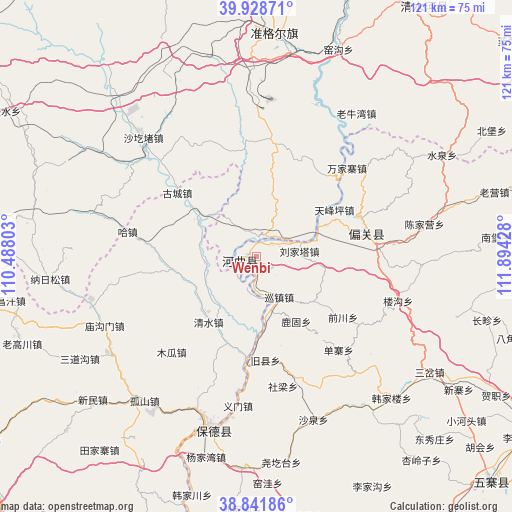
Wenbi GPS coordinates[2]
39° 23' 14.64" North, 111° 11' 28.14" East
| Map corner | latitude | longitude |
|---|---|---|
| Upper-left | 39.92871°, | 110.48803° |
| Center: | 39.3874°, | 111.19115° |
| Lower-right: | 38.84186°, | 111.89428° |
| Map W x H: | 120.8×120.8 km | = 75.1×75.1mi |
| max Lat: | 53.31946° ⇑15.7% North |
| Wenbi: | 39.3874° |
| min Lat: | ⇓84.3% South 18.22056° |
| min Long | Wenbi | max Long |
| 75.07348° | 111.19115° | 134.28917° |
| W 33.7%⇐ | ⇒66.3% E |
Elevation
Elevation of Wenbi is 957 m = 3140 ft, and this is 472.2 m = 1549 ft above average elevation for this country.
| Max E: |
5622 m = 18445 ft | 15.4% |
| Wenbi | 957 m 3140 ft | |
| Avg. | 484.8 m = 1591 ft | |
Min E: |
-3 m = -10 ft | 84.6% |
See also: China elevation on elevation.city.
Geographical zone
Wenbi is located in North temperate zone (between Tropic of Cancer and the Arctic Circle). Distance of this Northern Tropic circle is 1773.5 km =1102 mi to South.| Distance of | km | miles | from Wenbi |
|---|---|---|---|
| North Pole | 5627.6 | 3496.8 | to North |
| Arctic Circle | 3021.7 | 1877.6 | to North |
| Tropic Cancer | 1773.5 | 1102 | to South |
| Equator | 4379.5 | 2721.3 | to South |


Nearby cities:
15 places around Wenbi: (largest is in red/bold)
• Bajiao
63.2 km =39.3 mi,  107°
107°
• Beibao
62.6 km =38.9 mi,  62°
62°
• Changzhen
56.5 km =35.1 mi, 105°
• Chengguan
71 km =44.1 mi,  35°
35°
• Dongguan
41.5 km =25.8 mi,  187°
187°
• Dongmugou
57.6 km =35.8 mi,  25°
25°
• Hezhi
65.5 km =40.7 mi,  119°
119°
• Liebu
66.1 km =41.1 mi,  95°
95°
• Nuanquan
57.9 km =36 mi,  53°
53°
• Shagedu
40.6 km =25.2 mi,  315°
315°
• Shantaizi
40.4 km =25.1 mi, 34°
• Xiaomiaozi
71.1 km =44.2 mi, 33°
• Xinguan
30.1 km =18.7 mi,  75°
75°
• Xuejiawan
53.4 km =33.2 mi,  2°
2°
• Yaogou
51.8 km =32.2 mi,  23°
23°
In other languages:
- In Chinese: Chiu-ho-ch’ü, Ho-ch’ü, Ho-ch’ü-ch’eng, Ho-ch’ü-hsien, 文笔, Hokühsien, Hokü
Sources, notices
• [Note1] Compared only with cities in China existing in our database
• [Src1] Map data: © OpenStreetMap contributors (CC-BY-SA)
• [Src2] Other city data from geonames.org with taken over terms of usage.
• [Src3] Geographical zone / Annual Mean Temperature by Robert A. Rohde @ Wikipedia
