Zari geodata
Zari (Tibet) is a seat of a fourth-order administrative division; located in China in Asia/Shanghai (GMT+8) time zone. In our database, there are 1268 cities with bigger population. Compared to other cities in China, 68.2% of cities are located further ↑North; 96.5% of cities are located further →East and 97.6% of cities have lower elevation than Zari. Note1


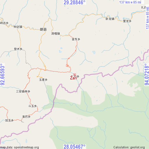
Zari GPS coordinates[2]
28° 40' 24.168" North, 93° 22' 8.58" East
| Map corner | latitude | longitude |
|---|---|---|
| Upper-left | 29.28846°, | 92.66593° |
| Center: | 28.67338°, | 93.36905° |
| Lower-right: | 28.05467°, | 94.07218° |
| Map W x H: | 137.2×137.2 km | = 85.3×85.3mi |
| max Lat: | 53.31946° ⇑68.2% North |
| Zari: | 28.67338° |
| min Lat: | ⇓31.8% South 18.22056° |
| min Long | Zari | max Long |
| 75.07348° | 93.36905° | 134.28917° |
| W 3.5%⇐ | ⇒96.5% E |
Elevation
Elevation of Zari is 3396 m = 11142 ft, and this is 2911.2 m = 9551 ft above average elevation for this country.
| Max E: |
5622 m = 18445 ft | 2.4% |
| Zari | 3396 m 11142 ft | |
| Avg. | 484.8 m = 1591 ft | |
Min E: |
-3 m = -10 ft | 97.6% |
See also: China elevation on elevation.city.
Geographical zone
Zari is located in North temperate zone (between Tropic of Cancer and the Arctic Circle). Distance of this Northern Tropic circle is 582.3 km =361.8 mi to South.| Distance of | km | miles | from Zari |
|---|---|---|---|
| North Pole | 6818.9 | 4237.1 | to North |
| Arctic Circle | 4213 | 2617.8 | to North |
| Tropic Cancer | 582.3 | 361.8 | to South |
| Equator | 3188.2 | 1981.1 | to South |


Nearby cities:
15 places around Zari: (largest is in red/bold)
• Dengmu
57.2 km =35.5 mi,  294°
294°
• Douyu
47.8 km =29.7 mi,  231°
231°
• Jindong
33.1 km =20.6 mi,  2°
2°
• Laduo
46.1 km =28.6 mi,  323°
323°
• Lang
55.3 km =34.4 mi, 316°
• Nailung
69 km =42.9 mi,  44°
44°
• Nangxian
49.8 km =30.9 mi,  326°
326°
• Nanyi
97.9 km =60.8 mi,  54°
54°
• Ngarrab
92.2 km =57.3 mi,  304°
304°
• Orong
60.1 km =37.3 mi,  34°
34°
• Rinang
82.9 km =51.5 mi, 296°
• Tungdor
90.9 km =56.5 mi, 49°
• Tunggar
41.1 km =25.5 mi,  335°
335°
• Zhaxirabdain
91.7 km =57 mi, 47°
• Zhomda
68.4 km =42.5 mi,  310°
310°
Sources, notices
• [Note1] Compared only with cities in China existing in our database
• [Src1] Map data: © OpenStreetMap contributors (CC-BY-SA)
• [Src2] Other city data from geonames.org with taken over terms of usage.
• [Src3] Geographical zone / Annual Mean Temperature by Robert A. Rohde @ Wikipedia
