Nangxian geodata
Nangxian (Tibet) is a seat of a third-order administrative division; located in China in Asia/Shanghai (GMT+8) time zone. In our database, there are 1268 cities with bigger population. Compared to other cities in China, 64.9% of cities are located further ↑North; 96.6% of cities are located further →East and 97.5% of cities have lower elevation than Nangxian. Note1


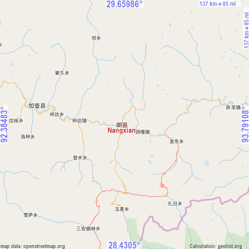
Nangxian GPS coordinates[2]
29° 2' 49.236" North, 93° 5' 16.62" East
| Map corner | latitude | longitude |
|---|---|---|
| Upper-left | 29.65986°, | 92.38483° |
| Center: | 29.04701°, | 93.08795° |
| Lower-right: | 28.4305°, | 93.79108° |
| Map W x H: | 136.7×136.7 km | = 84.9×84.9mi |
| max Lat: | 53.31946° ⇑64.9% North |
| Nangxian: | 29.04701° |
| min Lat: | ⇓35.1% South 18.22056° |
| min Long | Nangxian | max Long |
| 75.07348° | 93.08795° | 134.28917° |
| W 3.4%⇐ | ⇒96.6% E |
Elevation
Elevation of Nangxian is 3327 m = 10915 ft, and this is 2842.2 m = 9325 ft above average elevation for this country.
| Max E: |
5622 m = 18445 ft | 2.5% |
| Nangxian | 3327 m 10915 ft | |
| Avg. | 484.8 m = 1591 ft | |
Min E: |
-3 m = -10 ft | 97.5% |
See also: China elevation on elevation.city.
Geographical zone
Nangxian is located in North temperate zone (between Tropic of Cancer and the Arctic Circle). Distance of this Northern Tropic circle is 623.8 km =387.6 mi to South.| Distance of | km | miles | from Nangxian |
|---|---|---|---|
| North Pole | 6777.3 | 4211.2 | to North |
| Arctic Circle | 4171.4 | 2592 | to North |
| Tropic Cancer | 623.8 | 387.6 | to South |
| Equator | 3229.7 | 2006.8 | to South |


Nearby cities:
15 places around Nangxian: (largest is in red/bold)
• Bacun
50.4 km =31.3 mi,  342°
342°
• Cuijiu
57.5 km =35.7 mi,  320°
320°
• Dengmu
30.3 km =18.8 mi,  234°
234°
• Douyu
71.9 km =44.7 mi,  188°
188°
• Jindong
29.9 km =18.6 mi,  106°
106°
• Laduo
4.6 km =2.9 mi,  182°
182°
• Lang
10.6 km =6.6 mi,  263°
263°
• Nailung
76.2 km =47.3 mi,  84°
84°
• Ngarrab
49.6 km =30.8 mi,  282°
282°
• Norbusa
88.1 km =54.7 mi, 282°
• Orong
61.5 km =38.2 mi, 82°
• Rinang
46.9 km =29.1 mi, 264°
• Tunggar
11 km =6.8 mi, 112°
• Zari
49.8 km =30.9 mi,  146°
146°
• Zhomda
25.1 km =15.6 mi, 275°
Sources, notices
• [Note1] Compared only with cities in China existing in our database
• [Src1] Map data: © OpenStreetMap contributors (CC-BY-SA)
• [Src2] Other city data from geonames.org with taken over terms of usage.
• [Src3] Geographical zone / Annual Mean Temperature by Robert A. Rohde @ Wikipedia
