Ngarrab geodata
Ngarrab (Tibet) is a seat of a fourth-order administrative division; located in China in Asia/Shanghai (GMT+8) time zone. In our database, there are 1268 cities with bigger population. Compared to other cities in China, 63.9% of cities are located further ↑North; 96.7% of cities are located further →East and 97.3% of cities have lower elevation than Ngarrab. Note1


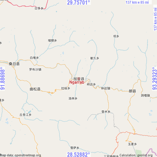
Ngarrab GPS coordinates[2]
29° 8' 41.1" North, 92° 35' 24.36" East
| Map corner | latitude | longitude |
|---|---|---|
| Upper-left | 29.75701°, | 91.88698° |
| Center: | 29.14475°, | 92.5901° |
| Lower-right: | 28.52882°, | 93.29323° |
| Map W x H: | 136.6×136.6 km | = 84.9×84.9mi |
| max Lat: | 53.31946° ⇑63.9% North |
| Ngarrab: | 29.14475° |
| min Lat: | ⇓36.1% South 18.22056° |
| min Long | Ngarrab | max Long |
| 75.07348° | 92.5901° | 134.28917° |
| W 3.3%⇐ | ⇒96.7% E |
Elevation
Elevation of Ngarrab is 3261 m = 10699 ft, and this is 2776.2 m = 9108 ft above average elevation for this country.
| Max E: |
5622 m = 18445 ft | 2.7% |
| Ngarrab | 3261 m 10699 ft | |
| Avg. | 484.8 m = 1591 ft | |
Min E: |
-3 m = -10 ft | 97.3% |
See also: China elevation on elevation.city.
Geographical zone
Ngarrab is located in North temperate zone (between Tropic of Cancer and the Arctic Circle). Distance of this Northern Tropic circle is 634.7 km =394.4 mi to South.| Distance of | km | miles | from Ngarrab |
|---|---|---|---|
| North Pole | 6766.5 | 4204.5 | to North |
| Arctic Circle | 4160.6 | 2585.3 | to North |
| Tropic Cancer | 634.7 | 394.4 | to South |
| Equator | 3240.6 | 2013.6 | to South |


Nearby cities:
15 places around Ngarrab: (largest is in red/bold)
• Bacun
49.8 km =30.9 mi,  41°
41°
• Changzhug
79.6 km =49.5 mi,  273°
273°
• Cuijiu
35.6 km =22.1 mi,  19°
19°
• Dengmu
37.2 km =23.1 mi,  140°
140°
• Jindong
79.4 km =49.3 mi,  104°
104°
• Laduo
50.6 km =31.4 mi,  107°
107°
• Lang
39.7 km =24.7 mi, 107°
• Naidong
80.1 km =49.8 mi,  277°
277°
• Nangxian
49.6 km =30.8 mi, 102°
• Norbusa
38.5 km =23.9 mi, 282°
• Pozhang
73.5 km =45.7 mi, 267°
• Rinang
15.3 km =9.5 mi,  173°
173°
• Sozhug
76.1 km =47.3 mi,  294°
294°
• Tunggar
60.4 km =37.5 mi, 104°
• Zhomda
24.9 km =15.5 mi, 109°
Sources, notices
• [Note1] Compared only with cities in China existing in our database
• [Src1] Map data: © OpenStreetMap contributors (CC-BY-SA)
• [Src2] Other city data from geonames.org with taken over terms of usage.
• [Src3] Geographical zone / Annual Mean Temperature by Robert A. Rohde @ Wikipedia
