Zhomda geodata
Zhomda (Tibet) is a seat of a fourth-order administrative division; located in China in Asia/Shanghai (GMT+8) time zone. In our database, there are 1268 cities with bigger population. Compared to other cities in China, 64.6% of cities are located further ↑North; 96.7% of cities are located further →East and 97.2% of cities have lower elevation than Zhomda. Note1


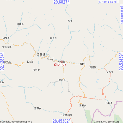
Zhomda GPS coordinates[2]
29° 4' 11.964" North, 92° 49' 53.256" East
| Map corner | latitude | longitude |
|---|---|---|
| Upper-left | 29.6827°, | 92.12834° |
| Center: | 29.06999°, | 92.83146° |
| Lower-right: | 28.45362°, | 93.53459° |
| Map W x H: | 136.7×136.7 km | = 84.9×84.9mi |
| max Lat: | 53.31946° ⇑64.6% North |
| Zhomda: | 29.06999° |
| min Lat: | ⇓35.4% South 18.22056° |
| min Long | Zhomda | max Long |
| 75.07348° | 92.83146° | 134.28917° |
| W 3.3%⇐ | ⇒96.7% E |
Elevation
Elevation of Zhomda is 3161 m = 10371 ft, and this is 2676.2 m = 8780 ft above average elevation for this country.
| Max E: |
5622 m = 18445 ft | 2.8% |
| Zhomda | 3161 m 10371 ft | |
| Avg. | 484.8 m = 1591 ft | |
Min E: |
-3 m = -10 ft | 97.2% |
See also: China elevation on elevation.city.
Geographical zone
Zhomda is located in North temperate zone (between Tropic of Cancer and the Arctic Circle). Distance of this Northern Tropic circle is 626.4 km =389.2 mi to South.| Distance of | km | miles | from Zhomda |
|---|---|---|---|
| North Pole | 6774.8 | 4209.7 | to North |
| Arctic Circle | 4168.9 | 2590.4 | to North |
| Tropic Cancer | 626.4 | 389.2 | to South |
| Equator | 3232.3 | 2008.5 | to South |


Nearby cities:
15 places around Zhomda: (largest is in red/bold)
• Bacun
46.5 km =28.9 mi,  12°
12°
• Cuijiu
43.4 km =27 mi,  344°
344°
• Dengmu
20.3 km =12.6 mi,  178°
178°
• Douyu
75.2 km =46.7 mi,  168°
168°
• Jindong
54.7 km =34 mi,  101°
101°
• Laduo
25.8 km =16 mi,  106°
106°
• Lang
14.9 km =9.3 mi, 104°
• Nangxian
25.1 km =15.6 mi, 95°
• Ngarrab
24.9 km =15.5 mi,  289°
289°
• Norbusa
63.3 km =39.3 mi, 285°
• Orong
86 km =53.4 mi,  86°
86°
• Pozhang
97 km =60.3 mi,  272°
272°
• Rinang
22.8 km =14.2 mi,  252°
252°
• Tunggar
35.7 km =22.2 mi, 100°
• Zari
68.4 km =42.5 mi,  130°
130°
Sources, notices
• [Note1] Compared only with cities in China existing in our database
• [Src1] Map data: © OpenStreetMap contributors (CC-BY-SA)
• [Src2] Other city data from geonames.org with taken over terms of usage.
• [Src3] Geographical zone / Annual Mean Temperature by Robert A. Rohde @ Wikipedia
