Nailung geodata
Nailung (Tibet) is a seat of a fourth-order administrative division; located in China in Asia/Shanghai (GMT+8) time zone. In our database, there are 1268 cities with bigger population. Compared to other cities in China, 64.2% of cities are located further ↑North; 96.4% of cities are located further →East and 96.9% of cities have lower elevation than Nailung. Note1


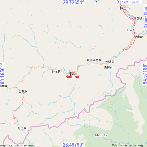
Nailung GPS coordinates[2]
29° 6' 50.76" North, 93° 52' 7.428" East
| Map corner | latitude | longitude |
|---|---|---|
| Upper-left | 29.72654°, | 93.16561° |
| Center: | 29.1141°, | 93.86873° |
| Lower-right: | 28.49799°, | 94.57186° |
| Map W x H: | 136.6×136.6 km | = 84.9×84.9mi |
| max Lat: | 53.31946° ⇑64.2% North |
| Nailung: | 29.1141° |
| min Lat: | ⇓35.8% South 18.22056° |
| min Long | Nailung | max Long |
| 75.07348° | 93.86873° | 134.28917° |
| W 3.6%⇐ | ⇒96.4% E |
Elevation
Elevation of Nailung is 2967 m = 9734 ft, and this is 2482.2 m = 8144 ft above average elevation for this country.
| Max E: |
5622 m = 18445 ft | 3.1% |
| Nailung | 2967 m 9734 ft | |
| Avg. | 484.8 m = 1591 ft | |
Min E: |
-3 m = -10 ft | 96.9% |
See also: China elevation on elevation.city.
Geographical zone
Nailung is located in North temperate zone (between Tropic of Cancer and the Arctic Circle). Distance of this Northern Tropic circle is 631.3 km =392.3 mi to South.| Distance of | km | miles | from Nailung |
|---|---|---|---|
| North Pole | 6769.9 | 4206.6 | to North |
| Arctic Circle | 4164 | 2587.4 | to North |
| Tropic Cancer | 631.3 | 392.3 | to South |
| Equator | 3237.2 | 2011.5 | to South |


Nearby cities:
15 places around Nailung: (largest is in red/bold)
• Baiba
76.2 km =47.3 mi,  358°
358°
• Bayi
76.9 km =47.8 mi,  38°
38°
• Gengzhang
71.6 km =44.5 mi,  17°
17°
• Jindong
49.9 km =31 mi,  251°
251°
• Laduo
77 km =47.8 mi,  261°
261°
• Mainling
35.4 km =22 mi,  71°
71°
• Nangxian
76.2 km =47.3 mi, 264°
• Nanyi
32.1 km =19.9 mi,  76°
76°
• Orong
14.9 km =9.3 mi,  272°
272°
• Puqu
66.3 km =41.2 mi,  53°
53°
• Tungdor
22.9 km =14.2 mi, 65°
• Tunggar
66.8 km =41.5 mi, 259°
• Yinla
78.7 km =48.9 mi, 49°
• Zari
69 km =42.9 mi,  224°
224°
• Zhaxirabdain
22.9 km =14.2 mi,  55°
55°
Sources, notices
• [Note1] Compared only with cities in China existing in our database
• [Src1] Map data: © OpenStreetMap contributors (CC-BY-SA)
• [Src2] Other city data from geonames.org with taken over terms of usage.
• [Src3] Geographical zone / Annual Mean Temperature by Robert A. Rohde @ Wikipedia
