Tungdor geodata
Tungdor (Tibet) is a seat of a third-order administrative division; located in China in Asia/Shanghai (GMT+8) time zone. In our database, there are 1268 cities with bigger population. Compared to other cities in China, 63.2% of cities are located further ↑North; 96.4% of cities are located further →East and 96.8% of cities have lower elevation than Tungdor. Note1


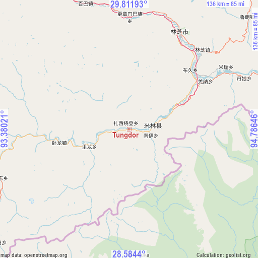
Tungdor GPS coordinates[2]
29° 12' 0" North, 94° 4' 59.988" East
| Map corner | latitude | longitude |
|---|---|---|
| Upper-left | 29.81193°, | 93.38021° |
| Center: | 29.2°, | 94.08333° |
| Lower-right: | 28.5844°, | 94.78646° |
| Map W x H: | 136.5×136.5 km | = 84.8×84.8mi |
| max Lat: | 53.31946° ⇑63.2% North |
| Tungdor: | 29.2° |
| min Lat: | ⇓36.8% South 18.22056° |
| min Long | Tungdor | max Long |
| 75.07348° | 94.08333° | 134.28917° |
| W 3.6%⇐ | ⇒96.4% E |
Elevation
Elevation of Tungdor is 2952 m = 9685 ft, and this is 2467.2 m = 8094 ft above average elevation for this country.
| Max E: |
5622 m = 18445 ft | 3.2% |
| Tungdor | 2952 m 9685 ft | |
| Avg. | 484.8 m = 1591 ft | |
Min E: |
-3 m = -10 ft | 96.8% |
See also: China elevation on elevation.city.
Geographical zone
Tungdor is located in North temperate zone (between Tropic of Cancer and the Arctic Circle). Distance of this Northern Tropic circle is 640.8 km =398.2 mi to South.| Distance of | km | miles | from Tungdor |
|---|---|---|---|
| North Pole | 6760.3 | 4200.7 | to North |
| Arctic Circle | 4154.4 | 2581.4 | to North |
| Tropic Cancer | 640.8 | 398.2 | to South |
| Equator | 3246.7 | 2017.4 | to South |


Nearby cities:
15 places around Tungdor: (largest is in red/bold)
• Baiba
70.3 km =43.7 mi,  341°
341°
• Bayi
57.5 km =35.7 mi,  27°
27°
• Damnyain
66.2 km =41.1 mi,  65°
65°
• Gengzhang
58.7 km =36.5 mi,  0°
0°
• Jindong
72.7 km =45.2 mi,  249°
249°
• Lunang
86 km =53.4 mi,  46°
46°
• Mainling
12.8 km =8 mi,  81°
81°
• Mainri
61 km =37.9 mi,  57°
57°
• Nailung
22.9 km =14.2 mi, 245°
• Nanyi
10.5 km =6.5 mi,  100°
100°
• Orong
36.8 km =22.9 mi,  256°
256°
• Paicun
81.6 km =50.7 mi, 65°
• Puqu
44.1 km =27.4 mi, 47°
• Yinla
57.1 km =35.5 mi,  42°
42°
• Zhaxirabdain
3.8 km =2.4 mi,  331°
331°
Sources, notices
• [Note1] Compared only with cities in China existing in our database
• [Src1] Map data: © OpenStreetMap contributors (CC-BY-SA)
• [Src2] Other city data from geonames.org with taken over terms of usage.
• [Src3] Geographical zone / Annual Mean Temperature by Robert A. Rohde @ Wikipedia
