Miaotang geodata
Miaotang (Chongqing) is a seat of a fourth-order administrative division; located in China in Asia/Shanghai (GMT+8) time zone. In our database, there are 1268 cities with bigger population. Compared to other cities in China, 57.5% of cities are located further ↓South; 70.7% of cities are located further →East and 86.8% of cities have lower elevation than Miaotang. Note1


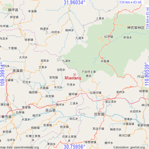
Miaotang GPS coordinates[2]
31° 21' 42.732" North, 110° 6' 8.136" East
| Map corner | latitude | longitude |
|---|---|---|
| Upper-left | 31.96034°, | 109.39914° |
| Center: | 31.36187°, | 110.10226° |
| Lower-right: | 30.75956°, | 110.80539° |
| Map W x H: | 133.5×133.5 km | = 83×83mi |
| max Lat: | 53.31946° ⇑42.5% North |
| Miaotang: | 31.36187° |
| min Lat: | ⇓57.5% South 18.22056° |
| min Long | Miaotang | max Long |
| 75.07348° | 110.10226° | 134.28917° |
| W 29.3%⇐ | ⇒70.7% E |
Elevation
Elevation of Miaotang is 1102 m = 3615 ft, and this is 617.2 m = 2025 ft above average elevation for this country.
| Max E: |
5622 m = 18445 ft | 13.2% |
| Miaotang | 1102 m 3615 ft | |
| Avg. | 484.8 m = 1591 ft | |
Min E: |
-3 m = -10 ft | 86.8% |
See also: China elevation on elevation.city.
Geographical zone
Miaotang is located in North temperate zone (between Tropic of Cancer and the Arctic Circle). Distance of this Northern Tropic circle is 881.2 km =547.6 mi to South.| Distance of | km | miles | from Miaotang |
|---|---|---|---|
| North Pole | 6519.9 | 4051.3 | to North |
| Arctic Circle | 3914.1 | 2432.1 | to North |
| Tropic Cancer | 881.2 | 547.6 | to South |
| Equator | 3487.1 | 2166.8 | to South |


Nearby cities:
15 places around Miaotang: (largest is in red/bold)
• Dachang
30.3 km =18.8 mi,  250°
250°
• Dangyang
12.8 km =8 mi,  292°
292°
• Guanyang
18.8 km =11.7 mi,  263°
263°
• Jinping
23.3 km =14.5 mi,  222°
222°
• Jiuhu
11.3 km =7 mi,  358°
358°
• Liangping
29.6 km =18.4 mi,  205°
205°
• Luoping
17.3 km =10.7 mi,  184°
184°
• Muyu
29.7 km =18.5 mi,  65°
65°
• Pinghe
18.5 km =11.5 mi,  232°
232°
• Sanxi
25.6 km =15.9 mi, 181°
• Shuanglong
28.1 km =17.5 mi, 228°
• Shuangyang
29.4 km =18.3 mi,  295°
295°
• Tongcheng
35.1 km =21.8 mi,  276°
276°
• Yanduhe
23.4 km =14.5 mi,  130°
130°
• Zhuxian
9.3 km =5.8 mi,  199°
199°
Sources, notices
• [Note1] Compared only with cities in China existing in our database
• [Src1] Map data: © OpenStreetMap contributors (CC-BY-SA)
• [Src2] Other city data from geonames.org with taken over terms of usage.
• [Src3] Geographical zone / Annual Mean Temperature by Robert A. Rohde @ Wikipedia
