Jiuhu geodata
Jiuhu (Hubei) is a seat of a fourth-order administrative division; located in China in Asia/Shanghai (GMT+8) time zone. In our database, there are 1268 cities with bigger population. Compared to other cities in China, 58.1% of cities are located further ↓South; 70.7% of cities are located further →East and 91.3% of cities have lower elevation than Jiuhu. Note1


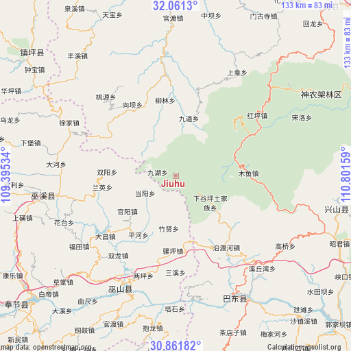
Jiuhu GPS coordinates[2]
31° 27' 48.528" North, 110° 5' 54.456" East
| Map corner | latitude | longitude |
|---|---|---|
| Upper-left | 32.0613°, | 109.39534° |
| Center: | 31.46348°, | 110.09846° |
| Lower-right: | 30.86182°, | 110.80159° |
| Map W x H: | 133.4×133.4 km | = 82.9×82.9mi |
| max Lat: | 53.31946° ⇑41.9% North |
| Jiuhu: | 31.46348° |
| min Lat: | ⇓58.1% South 18.22056° |
| min Long | Jiuhu | max Long |
| 75.07348° | 110.09846° | 134.28917° |
| W 29.3%⇐ | ⇒70.7% E |
Elevation
Elevation of Jiuhu is 1493 m = 4898 ft, and this is 1008.2 m = 3308 ft above average elevation for this country.
| Max E: |
5622 m = 18445 ft | 8.7% |
| Jiuhu | 1493 m 4898 ft | |
| Avg. | 484.8 m = 1591 ft | |
Min E: |
-3 m = -10 ft | 91.3% |
See also: China elevation on elevation.city.
Geographical zone
Jiuhu is located in North temperate zone (between Tropic of Cancer and the Arctic Circle). Distance of this Northern Tropic circle is 892.5 km =554.6 mi to South.| Distance of | km | miles | from Jiuhu |
|---|---|---|---|
| North Pole | 6508.7 | 4044.3 | to North |
| Arctic Circle | 3902.8 | 2425.1 | to North |
| Tropic Cancer | 892.5 | 554.6 | to South |
| Equator | 3498.4 | 2173.8 | to South |


Nearby cities:
15 places around Jiuhu: (largest is in red/bold)
• Dachang
35.5 km =22.1 mi,  232°
232°
• Dangyang
13.1 km =8.1 mi,  240°
240°
• Guanyang
22.8 km =14.2 mi, 233°
• Jinping
32.3 km =20.1 mi,  208°
208°
• Luoping
28.6 km =17.8 mi,  182°
182°
• Miaotang
11.3 km =7 mi, 178°
• Muyu
27.4 km =17 mi,  88°
88°
• Pinghe
26.8 km =16.7 mi, 212°
• Sanxi
36.9 km =22.9 mi, 180°
• Shuanglong
36.3 km =22.6 mi, 214°
• Shuangyang
26.2 km =16.3 mi,  273°
273°
• Tongcheng
35.3 km =21.9 mi,  257°
257°
• Xiangba
31.8 km =19.8 mi,  328°
328°
• Yanduhe
32.1 km =19.9 mi,  145°
145°
• Zhuxian
20.3 km =12.6 mi,  187°
187°
Sources, notices
• [Note1] Compared only with cities in China existing in our database
• [Src1] Map data: © OpenStreetMap contributors (CC-BY-SA)
• [Src2] Other city data from geonames.org with taken over terms of usage.
• [Src3] Geographical zone / Annual Mean Temperature by Robert A. Rohde @ Wikipedia
