Muye geodata
Muye (Chongqing) is a seat of a fourth-order administrative division; located in China in Asia/Shanghai (GMT+8) time zone. In our database, there are 1268 cities with bigger population. Compared to other cities in China, 62.6% of cities are located further ↑North; 76.3% of cities are located further →East and 84% of cities have lower elevation than Muye. Note1


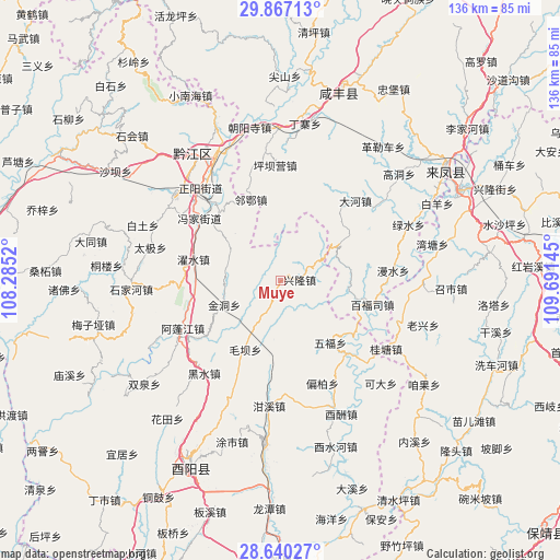
Muye GPS coordinates[2]
29° 15' 19.944" North, 108° 59' 17.952" East
| Map corner | latitude | longitude |
|---|---|---|
| Upper-left | 29.86713°, | 108.2852° |
| Center: | 29.25554°, | 108.98832° |
| Lower-right: | 28.64027°, | 109.69145° |
| Map W x H: | 136.4×136.4 km | = 84.8×84.8mi |
| max Lat: | 53.31946° ⇑62.6% North |
| Muye: | 29.25554° |
| min Lat: | ⇓37.4% South 18.22056° |
| min Long | Muye | max Long |
| 75.07348° | 108.98832° | 134.28917° |
| W 23.7%⇐ | ⇒76.3% E |
Elevation
Elevation of Muye is 918 m = 3012 ft, and this is 433.2 m = 1421 ft above average elevation for this country.
| Max E: |
5622 m = 18445 ft | 16% |
| Muye | 918 m 3012 ft | |
| Avg. | 484.8 m = 1591 ft | |
Min E: |
-3 m = -10 ft | 84% |
See also: China elevation on elevation.city.
Geographical zone
Muye is located in North temperate zone (between Tropic of Cancer and the Arctic Circle). Distance of this Northern Tropic circle is 647 km =402 mi to South.| Distance of | km | miles | from Muye |
|---|---|---|---|
| North Pole | 6754.2 | 4196.9 | to North |
| Arctic Circle | 4148.3 | 2577.6 | to North |
| Tropic Cancer | 647 | 402 | to South |
| Equator | 3252.9 | 2021.3 | to South |


Nearby cities:
15 places around Muye: (largest is in red/bold)
• Apengjiang
26.5 km =16.5 mi,  244°
244°
• Baifusi
23.1 km =14.4 mi,  104°
104°
• Chetian
13.8 km =8.6 mi,  156°
156°
• Dahe
26.9 km =16.7 mi,  43°
43°
• Daxi
23.7 km =14.7 mi,  139°
139°
• Fengjia
25 km =15.5 mi,  307°
307°
• Jindong
14.9 km =9.3 mi,  247°
247°
• Mala
13.7 km =8.5 mi,  282°
282°
• Maoba
18.8 km =11.7 mi,  207°
207°
• Pengdong
21.6 km =13.4 mi, 312°
• Pianbai
26.9 km =16.7 mi, 157°
• Wufu
19.5 km =12.1 mi, 139°
• Wuli
15.9 km =9.9 mi,  316°
316°
• Xinglong
4.7 km =2.9 mi,  86°
86°
• Zhuoshui
21.8 km =13.5 mi, 284°
Sources, notices
• [Note1] Compared only with cities in China existing in our database
• [Src1] Map data: © OpenStreetMap contributors (CC-BY-SA)
• [Src2] Other city data from geonames.org with taken over terms of usage.
• [Src3] Geographical zone / Annual Mean Temperature by Robert A. Rohde @ Wikipedia
