Erdaowan geodata
Erdaowan (Heilongjiang) is a seat of a fourth-order administrative division; located in China in Asia/Shanghai (GMT+8) time zone. In our database, there are 1268 cities with bigger population. Compared to other cities in China, 98.5% of cities are located further ↓South; 94.4% of cities are located further ←West and 53.7% of cities have lower elevation than Erdaowan. Note1


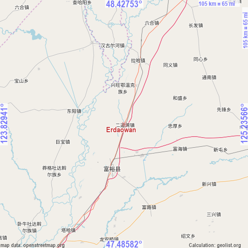
Erdaowan GPS coordinates[2]
47° 57' 31.752" North, 124° 31' 57.108" East
| Map corner | latitude | longitude |
|---|---|---|
| Upper-left | 48.42753°, | 123.82941° |
| Center: | 47.95882°, | 124.53253° |
| Lower-right: | 47.48582°, | 125.23566° |
| Map W x H: | 104.7×104.7 km | = 65.1×65.1mi |
| max Lat: | 53.31946° ⇑1.5% North |
| Erdaowan: | 47.95882° |
| min Lat: | ⇓98.5% South 18.22056° |
| min Long | Erdaowan | max Long |
| 75.07348° | 124.53253° | 134.28917° |
| W 94.4%⇐ | ⇒5.6% E |
Elevation
Elevation of Erdaowan is 195 m = 640 ft, and this is 289.8 m = 951 ft below average elevation for this country.
| Max E: |
5622 m = 18445 ft | 46.3% |
| Avg. | 484.8 m = 1591 ft | |
| Erdaowan | 195 m = 640 ft | |
Min E: |
-3 m = -10 ft | 53.7% |
See also: China elevation on elevation.city.
Geographical zone
Erdaowan is located in North temperate zone (between Tropic of Cancer and the Arctic Circle). Distance of this North polar circle is 2068.7 km =1285.4 mi to North.| Distance of | km | miles | from Erdaowan |
|---|---|---|---|
| North Pole | 4674.5 | 2904.6 | to North |
| Arctic Circle | 2068.7 | 1285.4 | to North |
| Tropic Cancer | 2726.6 | 1694.2 | to South |
| Equator | 5332.5 | 3313.5 | to South |


Nearby cities:
15 places around Erdaowan: (largest is in red/bold)
• Baoshan
47.5 km =29.5 mi,  293°
293°
• Borong
48.5 km =30.1 mi,  356°
356°
• Dongyang
22 km =13.7 mi, 285°
• Fuhai
26 km =16.2 mi,  112°
112°
• Fulu
36.7 km =22.8 mi,  162°
162°
• Fuyu
18.8 km =11.7 mi,  197°
197°
• Hangu Erhe
33.9 km =21.1 mi,  351°
351°
• Jubao
27 km =16.8 mi,  254°
254°
• Long’anqiao
49.4 km =30.7 mi,  187°
187°
• Manggetu Dawo’er Zu
35.5 km =22.1 mi,  236°
236°
• Pingyang
37.4 km =23.2 mi,  338°
338°
• Taha Man Zu
50.5 km =31.4 mi,  207°
207°
• Xintun
41.4 km =25.7 mi, 107°
• Xinxing
43.7 km =27.2 mi,  124°
124°
• Zhonghou
21.6 km =13.4 mi,  91°
91°
Sources, notices
• [Note1] Compared only with cities in China existing in our database
• [Src1] Map data: © OpenStreetMap contributors (CC-BY-SA)
• [Src2] Other city data from geonames.org with taken over terms of usage.
• [Src3] Geographical zone / Annual Mean Temperature by Robert A. Rohde @ Wikipedia
