Longping geodata
Longping (Hubei) is a seat of a fourth-order administrative division; located in China in Asia/Shanghai (GMT+8) time zone. In our database, there are 1268 cities with bigger population. Compared to other cities in China, 59.3% of cities are located further ↓South; 65.1% of cities are located further →East and 86.4% of cities have lower elevation than Longping. Note1


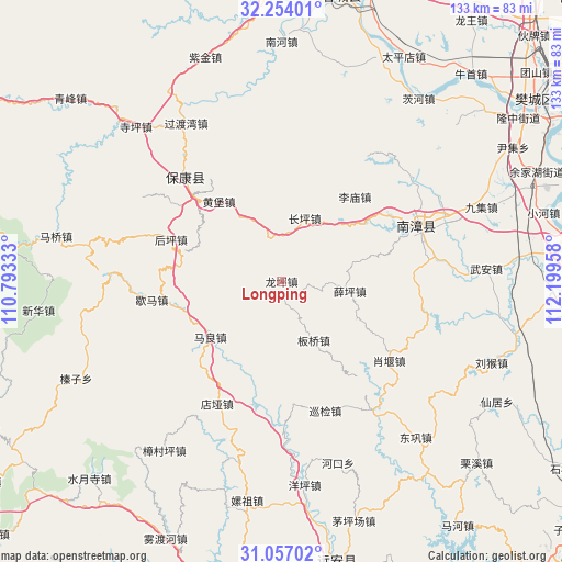
Longping GPS coordinates[2]
31° 39' 26.784" North, 111° 29' 47.22" East
| Map corner | latitude | longitude |
|---|---|---|
| Upper-left | 32.25401°, | 110.79333° |
| Center: | 31.65744°, | 111.49645° |
| Lower-right: | 31.05702°, | 112.19958° |
| Map W x H: | 133.1×133.1 km | = 82.7×82.7mi |
| max Lat: | 53.31946° ⇑40.7% North |
| Longping: | 31.65744° |
| min Lat: | ⇓59.3% South 18.22056° |
| min Long | Longping | max Long |
| 75.07348° | 111.49645° | 134.28917° |
| W 34.9%⇐ | ⇒65.1% E |
Elevation
Elevation of Longping is 1067 m = 3501 ft, and this is 582.2 m = 1910 ft above average elevation for this country.
| Max E: |
5622 m = 18445 ft | 13.6% |
| Longping | 1067 m 3501 ft | |
| Avg. | 484.8 m = 1591 ft | |
Min E: |
-3 m = -10 ft | 86.4% |
See also: China elevation on elevation.city.
Geographical zone
Longping is located in North temperate zone (between Tropic of Cancer and the Arctic Circle). Distance of this Northern Tropic circle is 914.1 km =568 mi to South.| Distance of | km | miles | from Longping |
|---|---|---|---|
| North Pole | 6487.1 | 4030.9 | to North |
| Arctic Circle | 3881.2 | 2411.7 | to North |
| Tropic Cancer | 914.1 | 568 | to South |
| Equator | 3520 | 2187.2 | to South |


Nearby cities:
15 places around Longping: (largest is in red/bold)
• Banqiao
16.5 km =10.3 mi,  149°
149°
• Baokang Chengguanzhen
33.4 km =20.8 mi,  317°
317°
• Changping
15.8 km =9.8 mi,  20°
20°
• Chengguan
35.6 km =22.1 mi,  67°
67°
• Dianya
32.6 km =20.3 mi,  208°
208°
• Guoduwan
43.7 km =27.2 mi,  328°
328°
• Houping
27.7 km =17.2 mi,  290°
290°
• Huangbao
24 km =14.9 mi, 321°
• Limiao
25.9 km =16.1 mi,  41°
41°
• Maliang
21.4 km =13.3 mi,  231°
231°
• Nanzhang Chengguanzhen
34.3 km =21.3 mi, 65°
• Xiaoyan
31.7 km =19.7 mi,  126°
126°
• Xiema
31 km =19.3 mi,  261°
261°
• Xueping
16.3 km =10.1 mi,  98°
98°
• Xunjian
32.1 km =19.9 mi,  160°
160°
Sources, notices
• [Note1] Compared only with cities in China existing in our database
• [Src1] Map data: © OpenStreetMap contributors (CC-BY-SA)
• [Src2] Other city data from geonames.org with taken over terms of usage.
• [Src3] Geographical zone / Annual Mean Temperature by Robert A. Rohde @ Wikipedia
