Baokang Chengguanzhen geodata
Baokang Chengguanzhen (Hubei) is a seat of a third-order administrative division; located in China in Asia/Shanghai (GMT+8) time zone. In our database, there are 1268 cities with bigger population. Compared to other cities in China, 60.5% of cities are located further ↓South; 66.1% of cities are located further →East and 63.6% of cities have lower elevation than Baokang Chengguanzhen. Note1


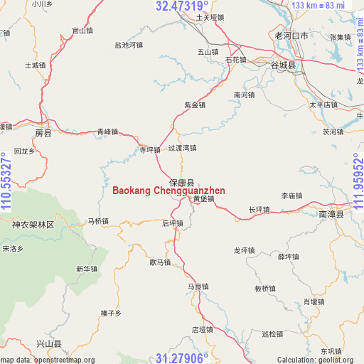
Baokang Chengguanzhen GPS coordinates[2]
31° 52' 41.016" North, 111° 15' 23.004" East
| Map corner | latitude | longitude |
|---|---|---|
| Upper-left | 32.47319°, | 110.55327° |
| Center: | 31.87806°, | 111.25639° |
| Lower-right: | 31.27906°, | 111.95952° |
| Map W x H: | 132.8×132.8 km | = 82.5×82.5mi |
| max Lat: | 53.31946° ⇑39.5% North |
| Baokang Chengguanzhen: | 31.87806° |
| min Lat: | ⇓60.5% South 18.22056° |
| min Long | Baokang Chenggu | max Long |
| 75.07348° | 111.25639° | 134.28917° |
| W 33.9%⇐ | ⇒66.1% E |
Elevation
Elevation of Baokang Chengguanzhen is 306 m = 1004 ft, and this is 178.8 m = 587 ft below average elevation for this country.
| Max E: |
5622 m = 18445 ft | 36.4% |
| Avg. | 484.8 m = 1591 ft | |
| Baokang Chengguanzhen | 306 m = 1004 ft | |
Min E: |
-3 m = -10 ft | 63.6% |
See also: China elevation on elevation.city.
Geographical zone
Baokang Chengguanzhen is located in North temperate zone (between Tropic of Cancer and the Arctic Circle). Distance of this Northern Tropic circle is 938.6 km =583.2 mi to South.| Distance of | km | miles | from Baokang Chengguanzhen |
|---|---|---|---|
| North Pole | 6462.6 | 4015.7 | to North |
| Arctic Circle | 3856.7 | 2396.4 | to North |
| Tropic Cancer | 938.6 | 583.2 | to South |
| Equator | 3544.5 | 2202.4 | to South |


Nearby cities:
15 places around Baokang Chengguanzhen: (largest is in red/bold)
• Changping
29.7 km =18.5 mi,  109°
109°
• Guoduwan
12.9 km =8 mi,  0°
0°
• Houping
15.3 km =9.5 mi,  192°
192°
• Huangbao
9.7 km =6 mi,  125°
125°
• Limiao
40.1 km =24.9 mi,  97°
97°
• Longping
33.4 km =20.8 mi,  137°
137°
• Maliang
38.2 km =23.7 mi,  171°
171°
• Maqiao
33.6 km =20.9 mi,  245°
245°
• Nanhe
40.6 km =25.2 mi,  35°
35°
• Qingfeng
33.1 km =20.6 mi,  304°
304°
• Siping
16.9 km =10.5 mi,  315°
315°
• Xiema
30 km =18.6 mi,  195°
195°
• Xueping
47.2 km =29.3 mi,  124°
124°
• Yangri
44.5 km =27.7 mi, 249°
• Zijin
28.9 km =18 mi,  9°
9°
Sources, notices
• [Note1] Compared only with cities in China existing in our database
• [Src1] Map data: © OpenStreetMap contributors (CC-BY-SA)
• [Src2] Other city data from geonames.org with taken over terms of usage.
• [Src3] Geographical zone / Annual Mean Temperature by Robert A. Rohde @ Wikipedia
