Huojian geodata
Huojian (Heilongjiang) is a seat of a fourth-order administrative division; located in China in Asia/Shanghai (GMT+8) time zone. In our database, there are 1268 cities with bigger population. Compared to other cities in China, 96.4% of cities are located further ↓South; 96% of cities are located further ←West and 51.6% of cities have lower elevation than Huojian. Note1


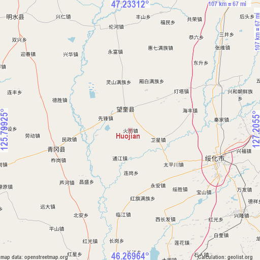
Huojian GPS coordinates[2]
46° 45' 12.708" North, 126° 30' 8.532" East
| Map corner | latitude | longitude |
|---|---|---|
| Upper-left | 47.23312°, | 125.79925° |
| Center: | 46.75353°, | 126.50237° |
| Lower-right: | 46.26964°, | 127.2055° |
| Map W x H: | 107.1×107.1 km | = 66.5×66.5mi |
| max Lat: | 53.31946° ⇑3.6% North |
| Huojian: | 46.75353° |
| min Lat: | ⇓96.4% South 18.22056° |
| min Long | Huojian | max Long |
| 75.07348° | 126.50237° | 134.28917° |
| W 96%⇐ | ⇒4% E |
Elevation
Elevation of Huojian is 178 m = 584 ft, and this is 306.8 m = 1007 ft below average elevation for this country.
| Max E: |
5622 m = 18445 ft | 48.4% |
| Avg. | 484.8 m = 1591 ft | |
| Huojian | 178 m = 584 ft | |
Min E: |
-3 m = -10 ft | 51.6% |
See also: China elevation on elevation.city.
Geographical zone
Huojian is located in North temperate zone (between Tropic of Cancer and the Arctic Circle). Distance of this North polar circle is 2202.7 km =1368.7 mi to North.| Distance of | km | miles | from Huojian |
|---|---|---|---|
| North Pole | 4808.6 | 2987.9 | to North |
| Arctic Circle | 2202.7 | 1368.7 | to North |
| Tropic Cancer | 2592.6 | 1611 | to South |
| Equator | 5198.5 | 3230.2 | to South |


Nearby cities:
15 places around Huojian: (largest is in red/bold)
• Changsheng
27.6 km =17.1 mi,  220°
220°
• Dengta
26.8 km =16.7 mi,  52°
52°
• Haifeng
26.1 km =16.2 mi,  71°
71°
• Hongqi
28.5 km =17.7 mi,  169°
169°
• Housan
22.2 km =13.8 mi,  328°
328°
• Lingshan
20.4 km =12.7 mi,  347°
347°
• Minzheng
25.3 km =15.7 mi,  261°
261°
• Qinggang
31.2 km =19.4 mi, 255°
• Taipingchuan
22.8 km =14.2 mi,  128°
128°
• Tongjiang
12 km =7.5 mi,  199°
199°
• Wangkui
9 km =5.6 mi, 347°
• Weixing
12.5 km =7.8 mi,  108°
108°
• Xiangbai
22.4 km =13.9 mi,  24°
24°
• Xinhua
28.6 km =17.8 mi,  115°
115°
• Yong’an
25.5 km =15.8 mi,  152°
152°
Sources, notices
• [Note1] Compared only with cities in China existing in our database
• [Src1] Map data: © OpenStreetMap contributors (CC-BY-SA)
• [Src2] Other city data from geonames.org with taken over terms of usage.
• [Src3] Geographical zone / Annual Mean Temperature by Robert A. Rohde @ Wikipedia
