Suohe geodata
Suohe (Hubei) is a seat of a fourth-order administrative division; located in China in Asia/Shanghai (GMT+8) time zone. In our database, there are 1268 cities with bigger population. Compared to other cities in China, 50.5% of cities are located further ↓South; 52% of cities are located further →East and 74.8% of cities have higher elevation than Suohe. Note1


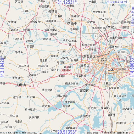
Suohe GPS coordinates[2]
30° 31' 17.436" North, 113° 53' 50.64" East
| Map corner | latitude | longitude |
|---|---|---|
| Upper-left | 31.12531°, | 113.19428° |
| Center: | 30.52151°, | 113.8974° |
| Lower-right: | 29.91393°, | 114.60053° |
| Map W x H: | 134.7×134.7 km | = 83.7×83.7mi |
| max Lat: | 53.31946° ⇑49.5% North |
| Suohe: | 30.52151° |
| min Lat: | ⇓50.5% South 18.22056° |
| min Long | Suohe | max Long |
| 75.07348° | 113.8974° | 134.28917° |
| W 48%⇐ | ⇒52% E |
Elevation
Elevation of Suohe is 37 m = 121 ft, and this is 447.8 m = 1469 ft below average elevation for this country.
| Max E: |
5622 m = 18445 ft | 74.8% |
| Avg. | 484.8 m = 1591 ft | |
| Suohe | 37 m = 121 ft | |
Min E: |
-3 m = -10 ft | 25.2% |
See also: China elevation on elevation.city.
Geographical zone
Suohe is located in North temperate zone (between Tropic of Cancer and the Arctic Circle). Distance of this Northern Tropic circle is 787.8 km =489.5 mi to South.| Distance of | km | miles | from Suohe |
|---|---|---|---|
| North Pole | 6613.4 | 4109.4 | to North |
| Arctic Circle | 4007.5 | 2490.1 | to North |
| Tropic Cancer | 787.8 | 489.5 | to South |
| Equator | 3393.7 | 2108.7 | to South |


Nearby cities:
15 places around Suohe: (largest is in red/bold)
• Caidian
14.7 km =9.1 mi,  62°
62°
• Chenghuang
17.2 km =10.7 mi,  310°
310°
• Daji
14 km =8.7 mi,  95°
95°
• Makou
8.1 km =5 mi, 310°
• Ma’an
9.8 km =6.1 mi,  343°
343°
• Miaotou
13.8 km =8.6 mi, 305°
• Nanhe
12.3 km =7.6 mi,  254°
254°
• Sheshan
13.3 km =8.3 mi,  128°
128°
• Xiannüshan
15 km =9.3 mi,  334°
334°
• Xingou
15.3 km =9.5 mi,  31°
31°
• Yong’an
7.3 km =4.5 mi,  155°
155°
• Yuxian
7.8 km =4.8 mi,  87°
87°
• Zhangwan
10.2 km =6.3 mi,  47°
47°
• Zhuru
10.7 km =6.6 mi,  213°
213°
• Zoumaling
18.5 km =11.5 mi,  37°
37°
Sources, notices
• [Note1] Compared only with cities in China existing in our database
• [Src1] Map data: © OpenStreetMap contributors (CC-BY-SA)
• [Src2] Other city data from geonames.org with taken over terms of usage.
• [Src3] Geographical zone / Annual Mean Temperature by Robert A. Rohde @ Wikipedia
