Ulan Us geodata
Ulan Us (Xinjiang) is a seat of a fourth-order administrative division; located in China in Asia/Urumqi (GMT+6) time zone. In our database, there are 1268 cities with bigger population. Compared to other cities in China, 93.2% of cities are located further ↓South; 98.4% of cities are located further →East and 73.2% of cities have lower elevation than Ulan Us. Note1


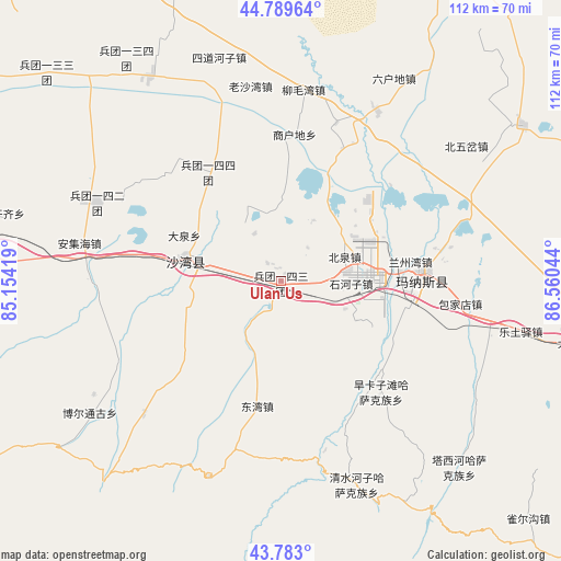
Ulan Us GPS coordinates[2]
44° 17' 18.528" North, 85° 51' 26.316" East
| Map corner | latitude | longitude |
|---|---|---|
| Upper-left | 44.78964°, | 85.15419° |
| Center: | 44.28848°, | 85.85731° |
| Lower-right: | 43.783°, | 86.56044° |
| Map W x H: | 111.9×111.9 km | = 69.5×69.5mi |
| max Lat: | 53.31946° ⇑6.8% North |
| Ulan Us: | 44.28848° |
| min Lat: | ⇓93.2% South 18.22056° |
| min Long | Ulan Us | max Long |
| 75.07348° | 85.85731° | 134.28917° |
| W 1.6%⇐ | ⇒98.4% E |
Elevation
Elevation of Ulan Us is 479 m = 1572 ft, and this is 5.8 m = 19 ft below average elevation for this country.
| Max E: |
5622 m = 18445 ft | 26.8% |
| Avg. | 484.8 m = 1591 ft | |
| Ulan Us | 479 m = 1572 ft | |
Min E: |
-3 m = -10 ft | 73.2% |
See also: China elevation on elevation.city.
Geographical zone
Ulan Us is located in North temperate zone (between Tropic of Cancer and the Arctic Circle). Distance of this Northern Tropic circle is 2318.5 km =1440.6 mi to South.| Distance of | km | miles | from Ulan Us |
|---|---|---|---|
| North Pole | 5082.6 | 3158.2 | to North |
| Arctic Circle | 2476.8 | 1539 | to North |
| Tropic Cancer | 2318.5 | 1440.6 | to South |
| Equator | 4924.4 | 3059.9 | to South |


Nearby cities:
15 places around Ulan Us: (largest is in red/bold)
• Anjihai
40.9 km =25.4 mi,  280°
280°
• Baojiadian
36.1 km =22.4 mi,  97°
97°
• Beiquan
13.4 km =8.3 mi,  66°
66°
• Daquan
23.5 km =14.6 mi,  290°
290°
• Dongwan
25.3 km =15.7 mi,  189°
189°
• Guangdongdi
31.4 km =19.5 mi,  77°
77°
• Hankazi
29.6 km =18.4 mi,  134°
134°
• Jingouhe
14 km =8.7 mi, 281°
• Laoshawan
39.5 km =24.5 mi,  351°
351°
• Liumaowan
35.2 km =21.9 mi,  6°
6°
• Manasi
28.4 km =17.6 mi,  85°
85°
• Sandaohezi
19.3 km =12 mi, 282°
• Shanghudi
27.1 km =16.8 mi,  2°
2°
• Shihezi
14.4 km =8.9 mi, 83°
• Xigebi
37.6 km =23.4 mi,  226°
226°
Sources, notices
• [Note1] Compared only with cities in China existing in our database
• [Src1] Map data: © OpenStreetMap contributors (CC-BY-SA)
• [Src2] Other city data from geonames.org with taken over terms of usage.
• [Src3] Geographical zone / Annual Mean Temperature by Robert A. Rohde @ Wikipedia
