Shanghudi geodata
Shanghudi (Heilongjiang) is a seat of a fourth-order administrative division; located in China in Asia/Urumqi (GMT+6) time zone. In our database, there are 1268 cities with bigger population. Compared to other cities in China, 93.4% of cities are located further ↓South; 98.4% of cities are located further →East and 68.7% of cities have lower elevation than Shanghudi. Note1


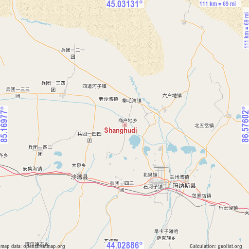
Shanghudi GPS coordinates[2]
44° 31' 56.064" North, 85° 52' 22.404" East
| Map corner | latitude | longitude |
|---|---|---|
| Upper-left | 45.03131°, | 85.16977° |
| Center: | 44.53224°, | 85.87289° |
| Lower-right: | 44.02886°, | 86.57602° |
| Map W x H: | 111.5×111.5 km | = 69.3×69.3mi |
| max Lat: | 53.31946° ⇑6.6% North |
| Shanghudi: | 44.53224° |
| min Lat: | ⇓93.4% South 18.22056° |
| min Long | Shanghudi | max Long |
| 75.07348° | 85.87289° | 134.28917° |
| W 1.6%⇐ | ⇒98.4% E |
Elevation
Elevation of Shanghudi is 388 m = 1273 ft, and this is 96.8 m = 318 ft below average elevation for this country.
| Max E: |
5622 m = 18445 ft | 31.3% |
| Avg. | 484.8 m = 1591 ft | |
| Shanghudi | 388 m = 1273 ft | |
Min E: |
-3 m = -10 ft | 68.7% |
See also: China elevation on elevation.city.
Geographical zone
Shanghudi is located in North temperate zone (between Tropic of Cancer and the Arctic Circle). Distance of this Northern Tropic circle is 2345.6 km =1457.5 mi to South.| Distance of | km | miles | from Shanghudi |
|---|---|---|---|
| North Pole | 5055.5 | 3141.3 | to North |
| Arctic Circle | 2449.7 | 1522.2 | to North |
| Tropic Cancer | 2345.6 | 1457.5 | to South |
| Equator | 4951.5 | 3076.7 | to South |


Nearby cities:
15 places around Shanghudi: (largest is in red/bold)
• Anjihai
45.7 km =28.4 mi,  244°
244°
• Baojiadian
46.7 km =29 mi,  132°
132°
• Beiquan
24.4 km =15.2 mi,  153°
153°
• Beiwucha
35.4 km =22 mi,  90°
90°
• Daquan
29.9 km =18.6 mi,  230°
230°
• Guangdongdi
35.7 km =22.2 mi,  124°
124°
• Hankazi
51.7 km =32.1 mi,  157°
157°
• Jingouhe
28.5 km =17.7 mi,  211°
211°
• Laoshawan
14 km =8.7 mi,  328°
328°
• Liumaowan
8.4 km =5.2 mi,  21°
21°
• Manasi
36.9 km =22.9 mi, 132°
• Sandaohezi
30.5 km =19 mi,  221°
221°
• Shihezi
28.7 km =17.8 mi, 152°
• Sidaohezi
21.9 km =13.6 mi,  322°
322°
• Ulan Us
27.1 km =16.8 mi,  182°
182°
Sources, notices
• [Note1] Compared only with cities in China existing in our database
• [Src1] Map data: © OpenStreetMap contributors (CC-BY-SA)
• [Src2] Other city data from geonames.org with taken over terms of usage.
• [Src3] Geographical zone / Annual Mean Temperature by Robert A. Rohde @ Wikipedia
