Liumaowan geodata
Liumaowan (Xinjiang) is a seat of a fourth-order administrative division; located in China in Asia/Urumqi (GMT+6) time zone. In our database, there are 1268 cities with bigger population. Compared to other cities in China, 93.6% of cities are located further ↓South; 98.4% of cities are located further →East and 67.3% of cities have lower elevation than Liumaowan. Note1


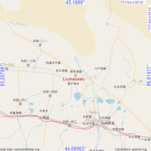
Liumaowan GPS coordinates[2]
44° 36' 8.748" North, 85° 54' 39.528" East
| Map corner | latitude | longitude |
|---|---|---|
| Upper-left | 45.1009°, | 85.20786° |
| Center: | 44.60243°, | 85.91098° |
| Lower-right: | 44.09965°, | 86.61411° |
| Map W x H: | 111.3×111.3 km | = 69.2×69.2mi |
| max Lat: | 53.31946° ⇑6.4% North |
| Liumaowan: | 44.60243° |
| min Lat: | ⇓93.6% South 18.22056° |
| min Long | Liumaowan | max Long |
| 75.07348° | 85.91098° | 134.28917° |
| W 1.6%⇐ | ⇒98.4% E |
Elevation
Elevation of Liumaowan is 364 m = 1194 ft, and this is 120.8 m = 396 ft below average elevation for this country.
| Max E: |
5622 m = 18445 ft | 32.7% |
| Avg. | 484.8 m = 1591 ft | |
| Liumaowan | 364 m = 1194 ft | |
Min E: |
-3 m = -10 ft | 67.3% |
See also: China elevation on elevation.city.
Geographical zone
Liumaowan is located in North temperate zone (between Tropic of Cancer and the Arctic Circle). Distance of this Northern Tropic circle is 2353.4 km =1462.3 mi to South.| Distance of | km | miles | from Liumaowan |
|---|---|---|---|
| North Pole | 5047.7 | 3136.5 | to North |
| Arctic Circle | 2441.8 | 1517.3 | to North |
| Tropic Cancer | 2353.4 | 1462.3 | to South |
| Equator | 4959.3 | 3081.6 | to South |


Nearby cities:
15 places around Liumaowan: (largest is in red/bold)
• Anjihai
52 km =32.3 mi,  238°
238°
• Baojiadian
50.3 km =31.3 mi,  141°
141°
• Beiquan
30.6 km =19 mi,  164°
164°
• Beiwucha
33.3 km =20.7 mi,  103°
103°
• Daquan
37.4 km =23.2 mi,  224°
224°
• Guangdongdi
38.5 km =23.9 mi, 136°
• Hankazi
58 km =36 mi, 163°
• Jingouhe
36.8 km =22.9 mi,  209°
209°
• Laoshawan
11.1 km =6.9 mi,  291°
291°
• Manasi
40.8 km =25.4 mi, 143°
• Sandaohezi
38.4 km =23.9 mi, 216°
• Shanghudi
8.4 km =5.2 mi,  201°
201°
• Shihezi
34.8 km =21.6 mi, 163°
• Sidaohezi
19 km =11.8 mi,  300°
300°
• Ulan Us
35.2 km =21.9 mi,  186°
186°
Sources, notices
• [Note1] Compared only with cities in China existing in our database
• [Src1] Map data: © OpenStreetMap contributors (CC-BY-SA)
• [Src2] Other city data from geonames.org with taken over terms of usage.
• [Src3] Geographical zone / Annual Mean Temperature by Robert A. Rohde @ Wikipedia
