Jiguanshi geodata
Jiguanshi (Chongqing) is a seat of a fourth-order administrative division; located in China in Asia/Shanghai (GMT+8) time zone. In our database, there are 1268 cities with bigger population. Compared to other cities in China, 58.7% of cities are located further ↑North; 84.8% of cities are located further →East and 58.9% of cities have lower elevation than Jiguanshi. Note1


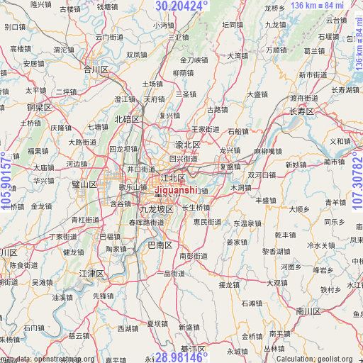
Jiguanshi GPS coordinates[2]
29° 35' 40.92" North, 106° 36' 16.884" East
| Map corner | latitude | longitude |
|---|---|---|
| Upper-left | 30.20424°, | 105.90157° |
| Center: | 29.5947°, | 106.60469° |
| Lower-right: | 28.98146°, | 107.30782° |
| Map W x H: | 136×136 km | = 84.5×84.5mi |
| max Lat: | 53.31946° ⇑58.7% North |
| Jiguanshi: | 29.5947° |
| min Lat: | ⇓41.3% South 18.22056° |
| min Long | Jiguanshi | max Long |
| 75.07348° | 106.60469° | 134.28917° |
| W 15.2%⇐ | ⇒84.8% E |
Elevation
Elevation of Jiguanshi is 246 m = 807 ft, and this is 238.8 m = 783 ft below average elevation for this country.
| Max E: |
5622 m = 18445 ft | 41.1% |
| Avg. | 484.8 m = 1591 ft | |
| Jiguanshi | 246 m = 807 ft | |
Min E: |
-3 m = -10 ft | 58.9% |
See also: China elevation on elevation.city.
Geographical zone
Jiguanshi is located in North temperate zone (between Tropic of Cancer and the Arctic Circle). Distance of this Northern Tropic circle is 684.7 km =425.5 mi to South.| Distance of | km | miles | from Jiguanshi |
|---|---|---|---|
| North Pole | 6716.4 | 4173.4 | to North |
| Arctic Circle | 4110.6 | 2554.2 | to North |
| Tropic Cancer | 684.7 | 425.5 | to South |
| Equator | 3290.6 | 2044.7 | to South |


Nearby cities:
15 places around Jiguanshi: (largest is in red/bold)
• Changshengqiao
11 km =6.8 mi,  150°
150°
• Chongqing
6.1 km =3.8 mi,  234°
234°
• Cuntan
3.4 km =2.1 mi,  284°
284°
• Dazhulin
14.2 km =8.8 mi, 284°
• Guangyang
14.3 km =8.9 mi,  94°
94°
• Huixing
10 km =6.2 mi,  5°
5°
• Lijia
14.3 km =8.9 mi,  310°
310°
• Nanping
6.2 km =3.9 mi,  195°
195°
• Renhe
8.3 km =5.2 mi,  293°
293°
• Shuangfengqiao
13.9 km =8.6 mi, 8°
• Yangjiaping
14.1 km =8.8 mi, 225°
• Yinglong
13.5 km =8.4 mi,  128°
128°
• Yuanyang
9.1 km =5.7 mi,  329°
329°
• Yufengshan
9.7 km =6 mi,  37°
37°
• Yuzui
15.5 km =9.6 mi,  79°
79°
Sources, notices
• [Note1] Compared only with cities in China existing in our database
• [Src1] Map data: © OpenStreetMap contributors (CC-BY-SA)
• [Src2] Other city data from geonames.org with taken over terms of usage.
• [Src3] Geographical zone / Annual Mean Temperature by Robert A. Rohde @ Wikipedia
