Yu’erhong geodata
Yu’erhong (Gansu) is a seat of a fourth-order administrative division; located in China in Asia/Urumqi (GMT+6) time zone. In our database, there are 1268 cities with bigger population. Compared to other cities in China, 85.3% of cities are located further ↓South; 95.6% of cities are located further →East and 97% of cities have lower elevation than Yu’erhong. Note1


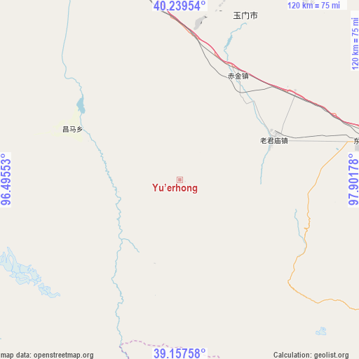
Yu’erhong GPS coordinates[2]
39° 42' 2.448" North, 97° 11' 55.14" East
| Map corner | latitude | longitude |
|---|---|---|
| Upper-left | 40.23954°, | 96.49553° |
| Center: | 39.70068°, | 97.19865° |
| Lower-right: | 39.15758°, | 97.90178° |
| Map W x H: | 120.3×120.3 km | = 74.8×74.8mi |
| max Lat: | 53.31946° ⇑14.7% North |
| Yu’erhong: | 39.70068° |
| min Lat: | ⇓85.3% South 18.22056° |
| min Long | Yu’erhong | max Long |
| 75.07348° | 97.19865° | 134.28917° |
| W 4.4%⇐ | ⇒95.6% E |
Elevation
Elevation of Yu’erhong is 3039 m = 9970 ft, and this is 2554.2 m = 8380 ft above average elevation for this country.
| Max E: |
5622 m = 18445 ft | 3% |
| Yu’erhong | 3039 m 9970 ft | |
| Avg. | 484.8 m = 1591 ft | |
Min E: |
-3 m = -10 ft | 97% |
See also: China elevation on elevation.city.
Geographical zone
Yu’erhong is located in North temperate zone (between Tropic of Cancer and the Arctic Circle). Distance of this Northern Tropic circle is 1808.4 km =1123.7 mi to South.| Distance of | km | miles | from Yu’erhong |
|---|---|---|---|
| North Pole | 5592.8 | 3475.2 | to North |
| Arctic Circle | 2986.9 | 1856 | to North |
| Tropic Cancer | 1808.4 | 1123.7 | to South |
| Equator | 4414.3 | 2742.9 | to South |


Nearby cities:
15 places around Yu’erhong: (largest is in red/bold)
• Changma
41.3 km =25.7 mi,  296°
296°
• Chijin
39.8 km =24.7 mi,  29°
29°
• Hedong
96.4 km =59.9 mi,  337°
337°
• Huahai
81.1 km =50.4 mi, 34°
• Huangzhawan
76.8 km =47.7 mi,  351°
351°
• Jiayuguan
93.8 km =58.3 mi,  82°
82°
• Laojunmiao
48 km =29.8 mi,  72°
72°
• Liuhe
81.8 km =50.8 mi, 344°
• Qiqing
89.7 km =55.7 mi,  129°
129°
• Qiwen
96.9 km =60.2 mi,  94°
94°
• Sandaogou
86.4 km =53.7 mi, 340°
• Xiaxihao
69.1 km =42.9 mi, 354°
• Yaozhanzi
95.4 km =59.3 mi,  334°
334°
• Yumen
64.8 km =40.3 mi,  0°
0°
• Yumendong
61 km =37.9 mi, 79°
Sources, notices
• [Note1] Compared only with cities in China existing in our database
• [Src1] Map data: © OpenStreetMap contributors (CC-BY-SA)
• [Src2] Other city data from geonames.org with taken over terms of usage.
• [Src3] Geographical zone / Annual Mean Temperature by Robert A. Rohde @ Wikipedia
