Yaozhanzi geodata
Yaozhanzi (Gansu) is a seat of a fourth-order administrative division; located in China in Asia/Urumqi (GMT+6) time zone. In our database, there are 1268 cities with bigger population. Compared to other cities in China, 88% of cities are located further ↓South; 95.7% of cities are located further →East and 90.5% of cities have lower elevation than Yaozhanzi. Note1


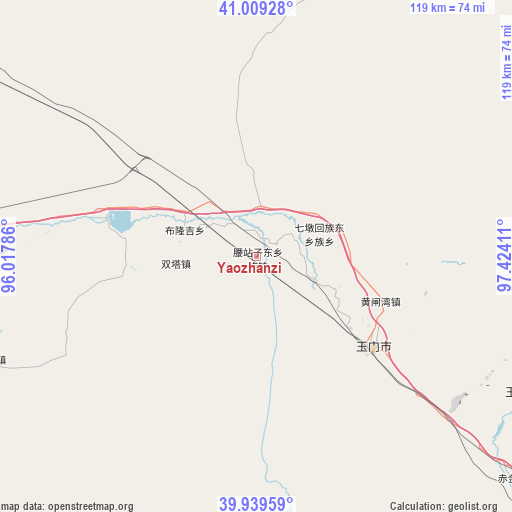
Yaozhanzi GPS coordinates[2]
40° 28' 35.652" North, 96° 43' 15.528" East
| Map corner | latitude | longitude |
|---|---|---|
| Upper-left | 41.00928°, | 96.01786° |
| Center: | 40.47657°, | 96.72098° |
| Lower-right: | 39.93959°, | 97.42411° |
| Map W x H: | 118.9×118.9 km | = 73.9×73.9mi |
| max Lat: | 53.31946° ⇑12% North |
| Yaozhanzi: | 40.47657° |
| min Lat: | ⇓88% South 18.22056° |
| min Long | Yaozhanzi | max Long |
| 75.07348° | 96.72098° | 134.28917° |
| W 4.3%⇐ | ⇒95.7% E |
Elevation
Elevation of Yaozhanzi is 1403 m = 4603 ft, and this is 918.2 m = 3012 ft above average elevation for this country.
| Max E: |
5622 m = 18445 ft | 9.5% |
| Yaozhanzi | 1403 m 4603 ft | |
| Avg. | 484.8 m = 1591 ft | |
Min E: |
-3 m = -10 ft | 90.5% |
See also: China elevation on elevation.city.
Geographical zone
Yaozhanzi is located in North temperate zone (between Tropic of Cancer and the Arctic Circle). Distance of this Northern Tropic circle is 1894.7 km =1177.3 mi to South.| Distance of | km | miles | from Yaozhanzi |
|---|---|---|---|
| North Pole | 5506.5 | 3421.6 | to North |
| Arctic Circle | 2900.6 | 1802.3 | to North |
| Tropic Cancer | 1894.7 | 1177.3 | to South |
| Equator | 4500.6 | 2796.5 | to South |


Nearby cities:
15 places around Yaozhanzi: (largest is in red/bold)
• Bulongji
16.4 km =10.2 mi,  291°
291°
• Changma
67.9 km =42.2 mi,  176°
176°
• Chijin
78.9 km =49 mi,  130°
130°
• Guazhou
88.8 km =55.2 mi,  269°
269°
• Hedong
5.2 km =3.2 mi,  54°
54°
• Huahai
88.1 km =54.7 mi,  102°
102°
• Huancheng
81 km =50.3 mi, 274°
• Huangzhawan
30.7 km =19.1 mi,  109°
109°
• Liuhe
19.7 km =12.2 mi, 112°
• Qiaozi
47.2 km =29.3 mi,  248°
248°
• Sandaogou
13 km =8.1 mi, 110°
• Tashi
67.1 km =41.7 mi, 249°
• Xiaxihao
37.9 km =23.5 mi,  117°
117°
• Yuanquan
77.9 km =48.4 mi, 271°
• Yumen
45.9 km =28.5 mi, 117°
Sources, notices
• [Note1] Compared only with cities in China existing in our database
• [Src1] Map data: © OpenStreetMap contributors (CC-BY-SA)
• [Src2] Other city data from geonames.org with taken over terms of usage.
• [Src3] Geographical zone / Annual Mean Temperature by Robert A. Rohde @ Wikipedia
