Changma geodata
Changma (Gansu) is a seat of a fourth-order administrative division; located in China in Asia/Shanghai (GMT+8) time zone. In our database, there are 1268 cities with bigger population. Compared to other cities in China, 85.9% of cities are located further ↓South; 95.7% of cities are located further →East and 94.8% of cities have lower elevation than Changma. Note1


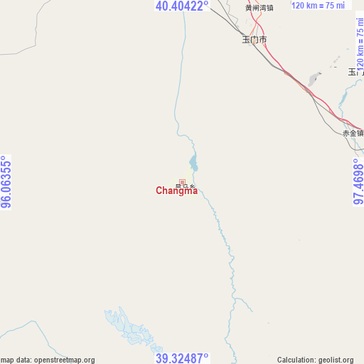
Changma GPS coordinates[2]
39° 52' 0.012" North, 96° 46' 0.012" East
| Map corner | latitude | longitude |
|---|---|---|
| Upper-left | 40.40422°, | 96.06355° |
| Center: | 39.86667°, | 96.76667° |
| Lower-right: | 39.32487°, | 97.4698° |
| Map W x H: | 120×120 km | = 74.6×74.6mi |
| max Lat: | 53.31946° ⇑14.1% North |
| Changma: | 39.86667° |
| min Lat: | ⇓85.9% South 18.22056° |
| min Long | Changma | max Long |
| 75.07348° | 96.76667° | 134.28917° |
| W 4.3%⇐ | ⇒95.7% E |
Elevation
Elevation of Changma is 2058 m = 6752 ft, and this is 1573.2 m = 5161 ft above average elevation for this country.
| Max E: |
5622 m = 18445 ft | 5.2% |
| Changma | 2058 m 6752 ft | |
| Avg. | 484.8 m = 1591 ft | |
Min E: |
-3 m = -10 ft | 94.8% |
See also: China elevation on elevation.city.
Geographical zone
Changma is located in North temperate zone (between Tropic of Cancer and the Arctic Circle). Distance of this Northern Tropic circle is 1826.8 km =1135.1 mi to South.| Distance of | km | miles | from Changma |
|---|---|---|---|
| North Pole | 5574.3 | 3463.7 | to North |
| Arctic Circle | 2968.4 | 1844.5 | to North |
| Tropic Cancer | 1826.8 | 1135.1 | to South |
| Equator | 4432.8 | 2754.4 | to South |


Nearby cities:
15 places around Changma: (largest is in red/bold)
• Bulongji
76.3 km =47.4 mi,  345°
345°
• Chijin
58.5 km =36.4 mi,  73°
73°
• Dongbatu
93 km =57.8 mi,  283°
283°
• Hedong
70.9 km =44.1 mi,  0°
0°
• Huangzhawan
62.8 km =39 mi,  23°
23°
• Laojunmiao
82.6 km =51.3 mi,  92°
92°
• Liuhe
62 km =38.5 mi,  13°
13°
• Qiaozi
70 km =43.5 mi,  316°
316°
• Sandaogou
63.7 km =39.6 mi, 7°
• Shibaocheng
60.2 km =37.4 mi,  262°
262°
• Tashi
80.1 km =49.8 mi,  303°
303°
• Xiaxihao
58.5 km =36.4 mi,  30°
30°
• Yaozhanzi
67.9 km =42.2 mi,  356°
356°
• Yumen
59.2 km =36.8 mi,  38°
38°
• Yu’erhong
41.3 km =25.7 mi,  116°
116°
Sources, notices
• [Note1] Compared only with cities in China existing in our database
• [Src1] Map data: © OpenStreetMap contributors (CC-BY-SA)
• [Src2] Other city data from geonames.org with taken over terms of usage.
• [Src3] Geographical zone / Annual Mean Temperature by Robert A. Rohde @ Wikipedia
