Tianshan geodata
Tianshan (Inner Mongolia) is a seat of a third-order administrative division; located in China in Asia/Shanghai (GMT+8) time zone. In our database, there are 1268 cities with bigger population. Compared to other cities in China, 92.6% of cities are located further ↓South; 82.5% of cities are located further ←West and 67.3% of cities have lower elevation than Tianshan. Note1


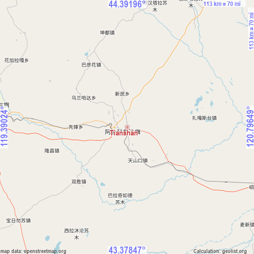
Tianshan GPS coordinates[2]
43° 53' 14.532" North, 120° 5' 36.096" East
| Map corner | latitude | longitude |
|---|---|---|
| Upper-left | 44.39196°, | 119.39024° |
| Center: | 43.88737°, | 120.09336° |
| Lower-right: | 43.37847°, | 120.79649° |
| Map W x H: | 112.7×112.7 km | = 70×70mi |
| max Lat: | 53.31946° ⇑7.4% North |
| Tianshan: | 43.88737° |
| min Lat: | ⇓92.6% South 18.22056° |
| min Long | Tianshan | max Long |
| 75.07348° | 120.09336° | 134.28917° |
| W 82.5%⇐ | ⇒17.5% E |
Elevation
Elevation of Tianshan is 365 m = 1198 ft, and this is 119.8 m = 393 ft below average elevation for this country.
| Max E: |
5622 m = 18445 ft | 32.7% |
| Avg. | 484.8 m = 1591 ft | |
| Tianshan | 365 m = 1198 ft | |
Min E: |
-3 m = -10 ft | 67.3% |
See also: China elevation on elevation.city.
Geographical zone
Tianshan is located in North temperate zone (between Tropic of Cancer and the Arctic Circle). Distance of this Northern Tropic circle is 2273.9 km =1412.9 mi to South.| Distance of | km | miles | from Tianshan |
|---|---|---|---|
| North Pole | 5127.2 | 3185.9 | to North |
| Arctic Circle | 2521.4 | 1566.7 | to North |
| Tropic Cancer | 2273.9 | 1412.9 | to South |
| Equator | 4879.8 | 3032.2 | to South |


Nearby cities:
15 places around Tianshan: (largest is in red/bold)
• Baga Borihe
113.4 km =70.5 mi,  160°
160°
• Bayan Tal
63.7 km =39.6 mi,  26°
26°
• Bayart Huxu
136.4 km =84.8 mi,  8°
8°
• Daban
121.2 km =75.3 mi,  251°
251°
• Daqin Tal
120.7 km =75 mi, 157°
• Dolod
127.8 km =79.4 mi,  57°
57°
• Holt
93.6 km =58.2 mi,  310°
310°
• Huanghuatala
147.6 km =91.7 mi, 157°
• Jurh
130.5 km =81.1 mi,  74°
74°
• Kailu
95.1 km =59.1 mi,  110°
110°
• Lindong
73.6 km =45.7 mi,  278°
278°
• Lubei
105.6 km =65.6 mi,  40°
40°
• Subrag
134.6 km =83.6 mi, 284°
• Wudan
136.7 km =84.9 mi,  219°
219°
• Yilongyong
145.8 km =90.6 mi, 162°
Sources, notices
• [Note1] Compared only with cities in China existing in our database
• [Src1] Map data: © OpenStreetMap contributors (CC-BY-SA)
• [Src2] Other city data from geonames.org with taken over terms of usage.
• [Src3] Geographical zone / Annual Mean Temperature by Robert A. Rohde @ Wikipedia
