Yanglong geodata
Yanglong (Qinghai) is a seat of a fourth-order administrative division; located in China in Asia/Shanghai (GMT+8) time zone. In our database, there are 1268 cities with bigger population. Compared to other cities in China, 82.3% of cities are located further ↓South; 95.3% of cities are located further →East and 97.8% of cities have lower elevation than Yanglong. Note1


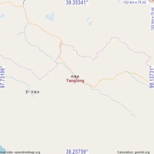
Yanglong GPS coordinates[2]
38° 48' 27.396" North, 98° 26' 3.048" East
| Map corner | latitude | longitude |
|---|---|---|
| Upper-left | 39.35341°, | 97.73106° |
| Center: | 38.80761°, | 98.43418° |
| Lower-right: | 38.25759°, | 99.13731° |
| Map W x H: | 121.8×121.8 km | = 75.7×75.7mi |
| max Lat: | 53.31946° ⇑17.7% North |
| Yanglong: | 38.80761° |
| min Lat: | ⇓82.3% South 18.22056° |
| min Long | Yanglong | max Long |
| 75.07348° | 98.43418° | 134.28917° |
| W 4.7%⇐ | ⇒95.3% E |
Elevation
Elevation of Yanglong is 3484 m = 11430 ft, and this is 2999.2 m = 9840 ft above average elevation for this country.
| Max E: |
5622 m = 18445 ft | 2.2% |
| Yanglong | 3484 m 11430 ft | |
| Avg. | 484.8 m = 1591 ft | |
Min E: |
-3 m = -10 ft | 97.8% |
See also: China elevation on elevation.city.
Geographical zone
Yanglong is located in North temperate zone (between Tropic of Cancer and the Arctic Circle). Distance of this Northern Tropic circle is 1709.1 km =1062 mi to South.| Distance of | km | miles | from Yanglong |
|---|---|---|---|
| North Pole | 5692.1 | 3536.9 | to North |
| Arctic Circle | 3086.2 | 1917.7 | to North |
| Tropic Cancer | 1709.1 | 1062 | to South |
| Equator | 4315 | 2681.2 | to South |


Nearby cities:
15 places around Yanglong: (largest is in red/bold)
• Dongdong
79.6 km =49.5 mi,  14°
14°
• Gahe
69.4 km =43.1 mi,  269°
269°
• Hongwansi
100.9 km =62.7 mi,  88°
88°
• Hongyazi
84.3 km =52.4 mi,  62°
62°
• Jinfosi
73.7 km =45.8 mi,  26°
26°
• Kekeli
89.7 km =55.7 mi,  121°
121°
• Muri
93 km =57.8 mi,  143°
143°
• Qingshui
88 km =54.7 mi,  43°
43°
• Qiqing
56.2 km =34.9 mi,  318°
318°
• Qiwen
91.5 km =56.9 mi,  354°
354°
• Wenshu
98.7 km =61.3 mi,  356°
356°
• Xiaheqing
96.1 km =59.7 mi, 28°
• Xidong
88.2 km =54.8 mi, 358°
• Xinba
92.7 km =57.6 mi,  65°
65°
• Zongzhai
91.1 km =56.6 mi, 9°
Sources, notices
• [Note1] Compared only with cities in China existing in our database
• [Src1] Map data: © OpenStreetMap contributors (CC-BY-SA)
• [Src2] Other city data from geonames.org with taken over terms of usage.
• [Src3] Geographical zone / Annual Mean Temperature by Robert A. Rohde @ Wikipedia
