Kekeli geodata
Kekeli (Qinghai) is a seat of a fourth-order administrative division; located in China in Asia/Shanghai (GMT+8) time zone. In our database, there are 1268 cities with bigger population. Compared to other cities in China, 81.6% of cities are located further ↓South; 95% of cities are located further →East and 98% of cities have lower elevation than Kekeli. Note1


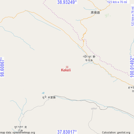
Kekeli GPS coordinates[2]
38° 23' 0.348" North, 99° 18' 42.444" East
| Map corner | latitude | longitude |
|---|---|---|
| Upper-left | 38.93249°, | 98.60867° |
| Center: | 38.38343°, | 99.31179° |
| Lower-right: | 37.83017°, | 100.01492° |
| Map W x H: | 122.6×122.6 km | = 76.2×76.2mi |
| max Lat: | 53.31946° ⇑18.4% North |
| Kekeli: | 38.38343° |
| min Lat: | ⇓81.6% South 18.22056° |
| min Long | Kekeli | max Long |
| 75.07348° | 99.31179° | 134.28917° |
| W 5%⇐ | ⇒95% E |
Elevation
Elevation of Kekeli is 3631 m = 11913 ft, and this is 3146.2 m = 10322 ft above average elevation for this country.
| Max E: |
5622 m = 18445 ft | 2% |
| Kekeli | 3631 m 11913 ft | |
| Avg. | 484.8 m = 1591 ft | |
Min E: |
-3 m = -10 ft | 98% |
See also: China elevation on elevation.city.
Geographical zone
Kekeli is located in North temperate zone (between Tropic of Cancer and the Arctic Circle). Distance of this Northern Tropic circle is 1661.9 km =1032.7 mi to South.| Distance of | km | miles | from Kekeli |
|---|---|---|---|
| North Pole | 5739.2 | 3566.2 | to North |
| Arctic Circle | 3133.3 | 1946.9 | to North |
| Tropic Cancer | 1661.9 | 1032.7 | to South |
| Equator | 4267.8 | 2651.9 | to South |


Nearby cities:
15 places around Kekeli: (largest is in red/bold)
• Baiyin
77.7 km =48.3 mi,  40°
40°
• Hongwansi
56.1 km =34.9 mi,  26°
26°
• Hongyazi
85.7 km =53.3 mi,  359°
359°
• Huazhai
94.8 km =58.9 mi,  73°
73°
• Longmen
65.7 km =40.8 mi,  211°
211°
• Muri
35.1 km =21.8 mi,  217°
217°
• Qilian
84.1 km =52.3 mi,  105°
105°
• Qinglong
64.7 km =40.2 mi, 31°
• Xinba
86.5 km =53.7 mi,  5°
5°
• Xishui
80.5 km =50 mi, 69°
• Yangkang
92.1 km =57.2 mi, 212°
• Yanglong
89.7 km =55.7 mi,  301°
301°
• Yeniugou
18.7 km =11.6 mi, 74°
• Zamashi
64.5 km =40.1 mi, 108°
• Zhugkyung
87.8 km =54.6 mi,  174°
174°
Sources, notices
• [Note1] Compared only with cities in China existing in our database
• [Src1] Map data: © OpenStreetMap contributors (CC-BY-SA)
• [Src2] Other city data from geonames.org with taken over terms of usage.
• [Src3] Geographical zone / Annual Mean Temperature by Robert A. Rohde @ Wikipedia
