Gangba geodata
Gangba (Tibet) is a seat of a third-order administrative division; located in China in Asia/Shanghai (GMT+8) time zone. In our database, there are 1268 cities with bigger population. Compared to other cities in China, 72.3% of cities are located further ↑North; 97.8% of cities are located further →East and 99.7% of cities have lower elevation than Gangba. Note1


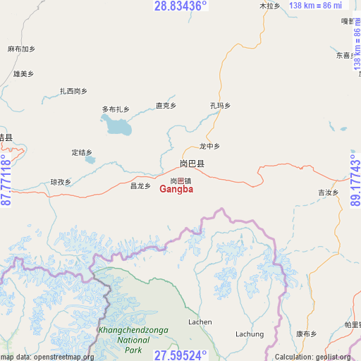
Gangba GPS coordinates[2]
28° 12' 59.76" North, 88° 28' 27.48" East
| Map corner | latitude | longitude |
|---|---|---|
| Upper-left | 28.83436°, | 87.77118° |
| Center: | 28.2166°, | 88.4743° |
| Lower-right: | 27.59524°, | 89.17743° |
| Map W x H: | 137.8×137.8 km | = 85.6×85.6mi |
| max Lat: | 53.31946° ⇑72.3% North |
| Gangba: | 28.2166° |
| min Lat: | ⇓27.7% South 18.22056° |
| min Long | Gangba | max Long |
| 75.07348° | 88.4743° | 134.28917° |
| W 2.2%⇐ | ⇒97.8% E |
Elevation
Elevation of Gangba is 4594 m = 15072 ft, and this is 4109.2 m = 13482 ft above average elevation for this country.
| Max E: |
5622 m = 18445 ft | 0.3% |
| Gangba | 4594 m 15072 ft | |
| Avg. | 484.8 m = 1591 ft | |
Min E: |
-3 m = -10 ft | 99.7% |
See also: China elevation on elevation.city.
Geographical zone
Gangba is located in North temperate zone (between Tropic of Cancer and the Arctic Circle). Distance of this Northern Tropic circle is 531.5 km =330.3 mi to South.| Distance of | km | miles | from Gangba |
|---|---|---|---|
| North Pole | 6869.7 | 4268.6 | to North |
| Arctic Circle | 4263.8 | 2649.4 | to North |
| Tropic Cancer | 531.5 | 330.3 | to South |
| Equator | 3137.4 | 1949.5 | to South |


Nearby cities:
15 places around Gangba: (largest is in red/bold)
• Dongxi
79.4 km =49.3 mi,  52°
52°
• Gala
89.1 km =55.4 mi,  86°
86°
• Gapu
89.2 km =55.4 mi, 46°
• Gyangkar
69.1 km =42.9 mi,  287°
287°
• Jiakexi
82.6 km =51.3 mi,  59°
59°
• Jiru
56.4 km =35 mi, 94°
• Kambaxoi
10.9 km =6.8 mi,  31°
31°
• Kamru
108.9 km =67.7 mi,  65°
65°
• Ma Xiang
105.4 km =65.5 mi,  35°
35°
• Pagri
85.5 km =53.1 mi,  127°
127°
• Sajia
88.2 km =54.8 mi,  331°
331°
• Samada
107.9 km =67 mi,  78°
78°
• Wangdain
98.1 km =61 mi, 42°
• Xarsingma
93.1 km =57.8 mi,  149°
149°
• Xiongzhang
97.6 km =60.6 mi, 62°
Sources, notices
• [Note1] Compared only with cities in China existing in our database
• [Src1] Map data: © OpenStreetMap contributors (CC-BY-SA)
• [Src2] Other city data from geonames.org with taken over terms of usage.
• [Src3] Geographical zone / Annual Mean Temperature by Robert A. Rohde @ Wikipedia
