Gala geodata
Gala (Tibet) is a seat of a fourth-order administrative division; located in China in Asia/Shanghai (GMT+8) time zone. In our database, there are 1268 cities with bigger population. Compared to other cities in China, 71.8% of cities are located further ↑North; 97.5% of cities are located further →East and 99.5% of cities have lower elevation than Gala. Note1


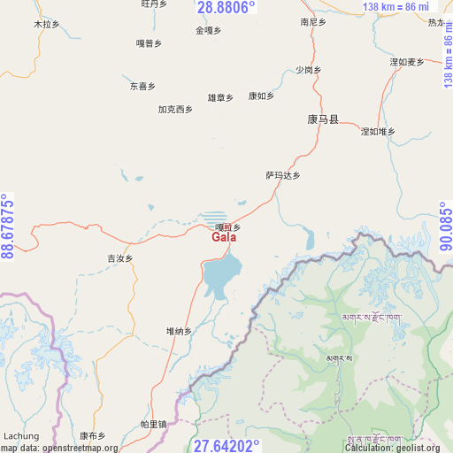
Gala GPS coordinates[2]
28° 15' 47.196" North, 89° 22' 54.732" East
| Map corner | latitude | longitude |
|---|---|---|
| Upper-left | 28.8806°, | 88.67875° |
| Center: | 28.26311°, | 89.38187° |
| Lower-right: | 27.64202°, | 90.085° |
| Map W x H: | 137.7×137.7 km | = 85.6×85.6mi |
| max Lat: | 53.31946° ⇑71.8% North |
| Gala: | 28.26311° |
| min Lat: | ⇓28.2% South 18.22056° |
| min Long | Gala | max Long |
| 75.07348° | 89.38187° | 134.28917° |
| W 2.5%⇐ | ⇒97.5% E |
Elevation
Elevation of Gala is 4445 m = 14583 ft, and this is 3960.2 m = 12993 ft above average elevation for this country.
| Max E: |
5622 m = 18445 ft | 0.5% |
| Gala | 4445 m 14583 ft | |
| Avg. | 484.8 m = 1591 ft | |
Min E: |
-3 m = -10 ft | 99.5% |
See also: China elevation on elevation.city.
Geographical zone
Gala is located in North temperate zone (between Tropic of Cancer and the Arctic Circle). Distance of this Northern Tropic circle is 536.6 km =333.4 mi to South.| Distance of | km | miles | from Gala |
|---|---|---|---|
| North Pole | 6864.5 | 4265.4 | to North |
| Arctic Circle | 4258.6 | 2646.2 | to North |
| Tropic Cancer | 536.6 | 333.4 | to South |
| Equator | 3142.6 | 1952.7 | to South |


Nearby cities:
15 places around Gala: (largest is in red/bold)
• Cheren
73.4 km =45.6 mi,  24°
24°
• Dongxi
50 km =31.1 mi,  329°
329°
• Gapu
60.6 km =37.7 mi,  337°
337°
• Jiakexi
40.6 km =25.2 mi, 334°
• Jiru
34 km =21.1 mi,  253°
253°
• Kamru
41.3 km =25.7 mi,  14°
14°
• Kangmar
44 km =27.3 mi,  41°
41°
• Kangzhuo
70.4 km =43.7 mi, 9°
• Nanni
67.7 km =42.1 mi, 22°
• Nieru
54.3 km =33.7 mi,  57°
57°
• Pagri
60.8 km =37.8 mi,  200°
200°
• Rixing
71.8 km =44.6 mi,  351°
351°
• Samada
23.1 km =14.4 mi,  47°
47°
• Wangdain
70.7 km =43.9 mi, 341°
• Xiongzhang
39.5 km =24.5 mi,  357°
357°
Sources, notices
• [Note1] Compared only with cities in China existing in our database
• [Src1] Map data: © OpenStreetMap contributors (CC-BY-SA)
• [Src2] Other city data from geonames.org with taken over terms of usage.
• [Src3] Geographical zone / Annual Mean Temperature by Robert A. Rohde @ Wikipedia
