Ya’ngan geodata
Ya’ngan (Tibet) is a seat of a fourth-order administrative division; located in China in Asia/Shanghai (GMT+8) time zone. In our database, there are 1268 cities with bigger population. Compared to other cities in China, 60.3% of cities are located further ↓South; 96.3% of cities are located further →East and 99% of cities have lower elevation than Ya’ngan. Note1


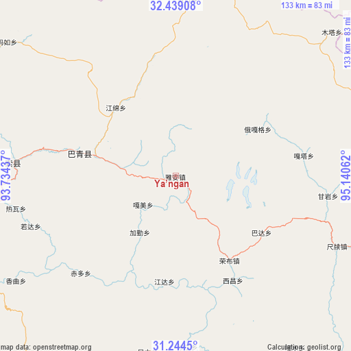
Ya’ngan GPS coordinates[2]
31° 50' 37.392" North, 94° 26' 14.964" East
| Map corner | latitude | longitude |
|---|---|---|
| Upper-left | 32.43908°, | 93.73437° |
| Center: | 31.84372°, | 94.43749° |
| Lower-right: | 31.2445°, | 95.14062° |
| Map W x H: | 132.8×132.8 km | = 82.5×82.5mi |
| max Lat: | 53.31946° ⇑39.7% North |
| Ya’ngan: | 31.84372° |
| min Lat: | ⇓60.3% South 18.22056° |
| min Long | Ya’ngan | max Long |
| 75.07348° | 94.43749° | 134.28917° |
| W 3.7%⇐ | ⇒96.3% E |
Elevation
Elevation of Ya’ngan is 4181 m = 13717 ft, and this is 3696.2 m = 12127 ft above average elevation for this country.
| Max E: |
5622 m = 18445 ft | 1% |
| Ya’ngan | 4181 m 13717 ft | |
| Avg. | 484.8 m = 1591 ft | |
Min E: |
-3 m = -10 ft | 99% |
See also: China elevation on elevation.city.
Geographical zone
Ya’ngan is located in North temperate zone (between Tropic of Cancer and the Arctic Circle). Distance of this Northern Tropic circle is 934.8 km =580.9 mi to South.| Distance of | km | miles | from Ya’ngan |
|---|---|---|---|
| North Pole | 6466.4 | 4018 | to North |
| Arctic Circle | 3860.5 | 2398.8 | to North |
| Tropic Cancer | 934.8 | 580.9 | to South |
| Equator | 3540.7 | 2200.1 | to South |


Nearby cities:
15 places around Ya’ngan: (largest is in red/bold)
• Chiduo
51.6 km =32.1 mi,  223°
223°
• Dartang
42.5 km =26.4 mi,  283°
283°
• Gamei
18 km =11.2 mi,  233°
233°
• Jamda
40.4 km =25.1 mi,  186°
186°
• Jiaqin
26.9 km =16.7 mi,  214°
214°
• Laxi
37.8 km =23.5 mi, 283°
• Nyinmo
66.8 km =41.5 mi, 188°
• Rawa
60.1 km =37.3 mi,  256°
256°
• Rogda
57.5 km =35.7 mi,  251°
251°
• Rongbo
36.8 km =22.9 mi,  149°
149°
• Sechang
44.9 km =27.9 mi, 152°
• Shading
65.3 km =40.6 mi,  175°
175°
• Xamqu
73.3 km =45.5 mi,  236°
236°
• Yag La
62.8 km =39 mi, 275°
• Zaindainxoi
72.8 km =45.2 mi,  270°
270°
Sources, notices
• [Note1] Compared only with cities in China existing in our database
• [Src1] Map data: © OpenStreetMap contributors (CC-BY-SA)
• [Src2] Other city data from geonames.org with taken over terms of usage.
• [Src3] Geographical zone / Annual Mean Temperature by Robert A. Rohde @ Wikipedia
