Yag La geodata
Yag La (Tibet) is a seat of a fourth-order administrative division; located in China in Asia/Shanghai (GMT+8) time zone. In our database, there are 1268 cities with bigger population. Compared to other cities in China, 60.5% of cities are located further ↓South; 96.5% of cities are located further →East and 98.8% of cities have lower elevation than Yag La. Note1


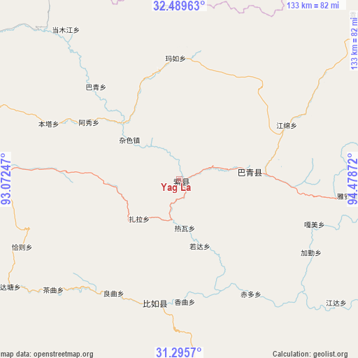
Yag La GPS coordinates[2]
31° 53' 40.56" North, 93° 46' 32.124" East
| Map corner | latitude | longitude |
|---|---|---|
| Upper-left | 32.48963°, | 93.07247° |
| Center: | 31.8946°, | 93.77559° |
| Lower-right: | 31.2957°, | 94.47872° |
| Map W x H: | 132.8×132.8 km | = 82.5×82.5mi |
| max Lat: | 53.31946° ⇑39.5% North |
| Yag La: | 31.8946° |
| min Lat: | ⇓60.5% South 18.22056° |
| min Long | Yag La | max Long |
| 75.07348° | 93.77559° | 134.28917° |
| W 3.5%⇐ | ⇒96.5% E |
Elevation
Elevation of Yag La is 4093 m = 13428 ft, and this is 3608.2 m = 11838 ft above average elevation for this country.
| Max E: |
5622 m = 18445 ft | 1.2% |
| Yag La | 4093 m 13428 ft | |
| Avg. | 484.8 m = 1591 ft | |
Min E: |
-3 m = -10 ft | 98.8% |
See also: China elevation on elevation.city.
Geographical zone
Yag La is located in North temperate zone (between Tropic of Cancer and the Arctic Circle). Distance of this Northern Tropic circle is 940.4 km =584.3 mi to South.| Distance of | km | miles | from Yag La |
|---|---|---|---|
| North Pole | 6460.7 | 4014.5 | to North |
| Arctic Circle | 3854.8 | 2395.3 | to North |
| Tropic Cancer | 940.4 | 584.3 | to South |
| Equator | 3546.3 | 2203.6 | to South |


Nearby cities:
15 places around Yag La: (largest is in red/bold)
• Biru
46.7 km =29 mi,  191°
191°
• Biruxong
57.3 km =35.6 mi,  196°
196°
• Caqu
62.2 km =38.6 mi,  228°
228°
• Chiduo
50.7 km =31.5 mi,  147°
147°
• Dartang
21.6 km =13.4 mi,  78°
78°
• Gamei
50.7 km =31.5 mi,  108°
108°
• Jiaqin
54.7 km =34 mi,  120°
120°
• Lainqu
48 km =29.8 mi,  210°
210°
• Laxi
25.8 km =16 mi, 83°
• Qiaze
60.5 km =37.6 mi,  250°
250°
• Rawa
19.7 km =12.2 mi,  168°
168°
• Rogda
25.3 km =15.7 mi,  161°
161°
• Xamqu
45.6 km =28.3 mi,  178°
178°
• Zaindainxoi
11.4 km =7.1 mi,  244°
244°
• Zala
21.3 km =13.2 mi, 227°
Sources, notices
• [Note1] Compared only with cities in China existing in our database
• [Src1] Map data: © OpenStreetMap contributors (CC-BY-SA)
• [Src2] Other city data from geonames.org with taken over terms of usage.
• [Src3] Geographical zone / Annual Mean Temperature by Robert A. Rohde @ Wikipedia
