Baiba geodata
Baiba (Tibet) is a seat of a fourth-order administrative division; located in China in Asia/Shanghai (GMT+8) time zone. In our database, there are 1268 cities with bigger population. Compared to other cities in China, 56.3% of cities are located further ↑North; 96.4% of cities are located further →East and 97.2% of cities have lower elevation than Baiba. Note1


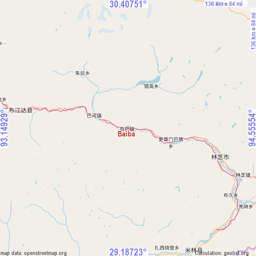
Baiba GPS coordinates[2]
29° 47' 57.228" North, 93° 51' 8.676" East
| Map corner | latitude | longitude |
|---|---|---|
| Upper-left | 30.40751°, | 93.14929° |
| Center: | 29.79923°, | 93.85241° |
| Lower-right: | 29.18723°, | 94.55554° |
| Map W x H: | 135.7×135.7 km | = 84.3×84.3mi |
| max Lat: | 53.31946° ⇑56.3% North |
| Baiba: | 29.79923° |
| min Lat: | ⇓43.7% South 18.22056° |
| min Long | Baiba | max Long |
| 75.07348° | 93.85241° | 134.28917° |
| W 3.6%⇐ | ⇒96.4% E |
Elevation
Elevation of Baiba is 3216 m = 10551 ft, and this is 2731.2 m = 8961 ft above average elevation for this country.
| Max E: |
5622 m = 18445 ft | 2.8% |
| Baiba | 3216 m 10551 ft | |
| Avg. | 484.8 m = 1591 ft | |
Min E: |
-3 m = -10 ft | 97.2% |
See also: China elevation on elevation.city.
Geographical zone
Baiba is located in North temperate zone (between Tropic of Cancer and the Arctic Circle). Distance of this Northern Tropic circle is 707.4 km =439.6 mi to South.| Distance of | km | miles | from Baiba |
|---|---|---|---|
| North Pole | 6693.7 | 4159.3 | to North |
| Arctic Circle | 4087.8 | 2540 | to North |
| Tropic Cancer | 707.4 | 439.6 | to South |
| Equator | 3313.4 | 2058.9 | to South |


Nearby cities:
15 places around Baiba: (largest is in red/bold)
• Bayi
51.4 km =31.9 mi,  107°
107°
• Damnyain
91.3 km =56.7 mi,  115°
115°
• Gengzhang
24.5 km =15.2 mi, 108°
• Lunang
84.6 km =52.6 mi,  94°
94°
• Mainling
73.5 km =45.7 mi,  151°
151°
• Mainri
80.6 km =50.1 mi, 114°
• Nailung
76.2 km =47.3 mi,  178°
178°
• Nanyi
75.9 km =47.2 mi, 154°
• Orong
76.6 km =47.6 mi,  189°
189°
• Puqu
65.7 km =40.8 mi, 123°
• Tungdor
70.3 km =43.7 mi,  161°
161°
• Xarlung
54.4 km =33.8 mi,  281°
281°
• Yinla
65.7 km =40.8 mi, 112°
• Zhaxirabdain
66.6 km =41.4 mi, 162°
• Zhongyu
78.2 km =48.6 mi,  10°
10°
Sources, notices
• [Note1] Compared only with cities in China existing in our database
• [Src1] Map data: © OpenStreetMap contributors (CC-BY-SA)
• [Src2] Other city data from geonames.org with taken over terms of usage.
• [Src3] Geographical zone / Annual Mean Temperature by Robert A. Rohde @ Wikipedia
