Yinla geodata
Yinla (Tibet) is a seat of a third-order administrative division; located in China in Asia/Shanghai (GMT+8) time zone. In our database, there are 1268 cities with bigger population. Compared to other cities in China, 58.9% of cities are located further ↑North; 96.3% of cities are located further →East and 96.9% of cities have lower elevation than Yinla. Note1


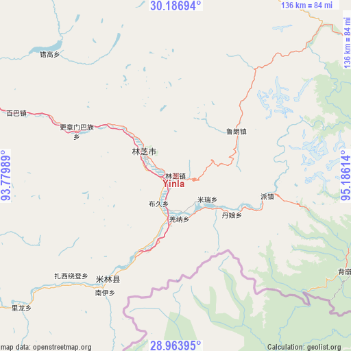
Yinla GPS coordinates[2]
29° 34' 38.28" North, 94° 28' 58.836" East
| Map corner | latitude | longitude |
|---|---|---|
| Upper-left | 30.18694°, | 93.77989° |
| Center: | 29.5773°, | 94.48301° |
| Lower-right: | 28.96395°, | 95.18614° |
| Map W x H: | 136×136 km | = 84.5×84.5mi |
| max Lat: | 53.31946° ⇑58.9% North |
| Yinla: | 29.5773° |
| min Lat: | ⇓41.1% South 18.22056° |
| min Long | Yinla | max Long |
| 75.07348° | 94.48301° | 134.28917° |
| W 3.7%⇐ | ⇒96.3% E |
Elevation
Elevation of Yinla is 3017 m = 9898 ft, and this is 2532.2 m = 8308 ft above average elevation for this country.
| Max E: |
5622 m = 18445 ft | 3.1% |
| Yinla | 3017 m 9898 ft | |
| Avg. | 484.8 m = 1591 ft | |
Min E: |
-3 m = -10 ft | 96.9% |
See also: China elevation on elevation.city.
Geographical zone
Yinla is located in North temperate zone (between Tropic of Cancer and the Arctic Circle). Distance of this Northern Tropic circle is 682.8 km =424.3 mi to South.| Distance of | km | miles | from Yinla |
|---|---|---|---|
| North Pole | 6718.4 | 4174.6 | to North |
| Arctic Circle | 4112.5 | 2555.4 | to North |
| Tropic Cancer | 682.8 | 424.3 | to South |
| Equator | 3288.7 | 2043.5 | to South |


Nearby cities:
15 places around Yinla: (largest is in red/bold)
• Baiba
65.7 km =40.8 mi,  292°
292°
• Bayi
15 km =9.3 mi,  306°
306°
• Damnyain
26 km =16.2 mi,  124°
124°
• Gengzhang
41.3 km =25.7 mi, 293°
• Lunang
29.2 km =18.1 mi,  53°
53°
• Mainling
47.8 km =29.7 mi,  213°
213°
• Mainri
15.2 km =9.4 mi,  125°
125°
• Motuo
85.1 km =52.9 mi,  110°
110°
• Nailung
78.7 km =48.9 mi,  229°
229°
• Nanyi
52.3 km =32.5 mi, 212°
• Orong
90.1 km =56 mi,  235°
235°
• Paicun
36.1 km =22.4 mi,  102°
102°
• Puqu
13.6 km =8.5 mi, 208°
• Tungdor
57.1 km =35.5 mi,  222°
222°
• Zhaxirabdain
56 km =34.8 mi, 226°
Sources, notices
• [Note1] Compared only with cities in China existing in our database
• [Src1] Map data: © OpenStreetMap contributors (CC-BY-SA)
• [Src2] Other city data from geonames.org with taken over terms of usage.
• [Src3] Geographical zone / Annual Mean Temperature by Robert A. Rohde @ Wikipedia
