Wosai geodata
Wosai (Qinghai) is a seat of a fourth-order administrative division; located in China in Asia/Shanghai (GMT+8) time zone. In our database, there are 1268 cities with bigger population. Compared to other cities in China, 68.4% of cities are located further ↓South; 94.7% of cities are located further →East and 98.7% of cities have lower elevation than Wosai. Note1


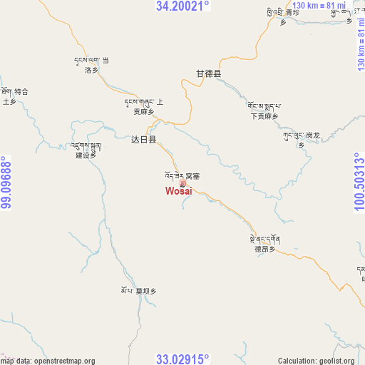
Wosai GPS coordinates[2]
33° 37' 0.012" North, 99° 48' 0" East
| Map corner | latitude | longitude |
|---|---|---|
| Upper-left | 34.20021°, | 99.09688° |
| Center: | 33.61667°, | 99.8° |
| Lower-right: | 33.02915°, | 100.50313° |
| Map W x H: | 130.2×130.2 km | = 80.9×80.9mi |
| max Lat: | 53.31946° ⇑31.6% North |
| Wosai: | 33.61667° |
| min Lat: | ⇓68.4% South 18.22056° |
| min Long | Wosai | max Long |
| 75.07348° | 99.8° | 134.28917° |
| W 5.3%⇐ | ⇒94.7% E |
Elevation
Elevation of Wosai is 4028 m = 13215 ft, and this is 3543.2 m = 11625 ft above average elevation for this country.
| Max E: |
5622 m = 18445 ft | 1.3% |
| Wosai | 4028 m 13215 ft | |
| Avg. | 484.8 m = 1591 ft | |
Min E: |
-3 m = -10 ft | 98.7% |
See also: China elevation on elevation.city.
Geographical zone
Wosai is located in North temperate zone (between Tropic of Cancer and the Arctic Circle). Distance of this Northern Tropic circle is 1131.9 km =703.3 mi to South.| Distance of | km | miles | from Wosai |
|---|---|---|---|
| North Pole | 6269.2 | 3895.5 | to North |
| Arctic Circle | 3663.4 | 2276.3 | to North |
| Tropic Cancer | 1131.9 | 703.3 | to South |
| Equator | 3737.8 | 2322.6 | to South |


Nearby cities:
15 places around Wosai: (largest is in red/bold)
• Basar
75.2 km =46.7 mi,  80°
80°
• Dagkar
73.5 km =45.7 mi,  160°
160°
• Dêrnang
39.6 km =24.6 mi,  120°
120°
• Ganglong
45.2 km =28.1 mi,  69°
69°
• Jianshe
37.8 km =23.5 mi,  281°
281°
• Jimai
20.5 km =12.7 mi,  316°
316°
• Kequ
40.2 km =25 mi,  13°
13°
• Kyinzhi
69 km =42.9 mi,  31°
31°
• Marzhing
65.9 km =40.9 mi, 122°
• Moba
41.7 km =25.9 mi,  201°
201°
• Sangruma
55.7 km =34.6 mi,  273°
273°
• Shanggongma
27.1 km =16.8 mi,  332°
332°
• Tanglag
53.5 km =33.2 mi, 322°
• Tehetu
69.2 km =43 mi,  296°
296°
• Xiagongma
39.4 km =24.5 mi,  59°
59°
Sources, notices
• [Note1] Compared only with cities in China existing in our database
• [Src1] Map data: © OpenStreetMap contributors (CC-BY-SA)
• [Src2] Other city data from geonames.org with taken over terms of usage.
• [Src3] Geographical zone / Annual Mean Temperature by Robert A. Rohde @ Wikipedia
