Kequ geodata
Kequ (Qinghai) is a seat of a third-order administrative division; located in China in Asia/Shanghai (GMT+8) time zone. In our database, there are 1268 cities with bigger population. Compared to other cities in China, 70% of cities are located further ↓South; 94.6% of cities are located further →East and 98.7% of cities have lower elevation than Kequ. Note1


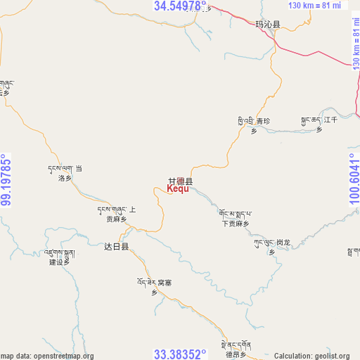
Kequ GPS coordinates[2]
33° 58' 7.14" North, 99° 54' 3.492" East
| Map corner | latitude | longitude |
|---|---|---|
| Upper-left | 34.54978°, | 99.19785° |
| Center: | 33.96865°, | 99.90097° |
| Lower-right: | 33.38352°, | 100.6041° |
| Map W x H: | 129.7×129.7 km | = 80.6×80.6mi |
| max Lat: | 53.31946° ⇑30% North |
| Kequ: | 33.96865° |
| min Lat: | ⇓70% South 18.22056° |
| min Long | Kequ | max Long |
| 75.07348° | 99.90097° | 134.28917° |
| W 5.4%⇐ | ⇒94.6% E |
Elevation
Elevation of Kequ is 4020 m = 13189 ft, and this is 3535.2 m = 11598 ft above average elevation for this country.
| Max E: |
5622 m = 18445 ft | 1.3% |
| Kequ | 4020 m 13189 ft | |
| Avg. | 484.8 m = 1591 ft | |
Min E: |
-3 m = -10 ft | 98.7% |
See also: China elevation on elevation.city.
Geographical zone
Kequ is located in North temperate zone (between Tropic of Cancer and the Arctic Circle). Distance of this Northern Tropic circle is 1171 km =727.6 mi to South.| Distance of | km | miles | from Kequ |
|---|---|---|---|
| North Pole | 6230.1 | 3871.2 | to North |
| Arctic Circle | 3624.2 | 2252 | to North |
| Tropic Cancer | 1171 | 727.6 | to South |
| Equator | 3777 | 2346.9 | to South |


Nearby cities:
15 places around Kequ: (largest is in red/bold)
• Basar
69.7 km =43.3 mi,  112°
112°
• Dawu
63.1 km =39.2 mi,  28°
28°
• Dawu
65.1 km =40.5 mi, 26°
• Dongqinggou
62 km =38.5 mi,  5°
5°
• Dêrnang
64.4 km =40 mi,  157°
157°
• Ganglong
40 km =24.9 mi,  124°
124°
• Gyangqai
51 km =31.7 mi,  64°
64°
• Jianshe
56.1 km =34.9 mi,  235°
235°
• Jimai
33.6 km =20.9 mi,  224°
224°
• Kyinzhi
33.1 km =20.6 mi,  53°
53°
• Shanggongma
26.3 km =16.3 mi, 235°
• Tanglag
42 km =26.1 mi,  274°
274°
• Tehetu
71.5 km =44.4 mi,  263°
263°
• Wosai
40.2 km =25 mi,  193°
193°
• Xiagongma
31.2 km =19.4 mi,  127°
127°
Sources, notices
• [Note1] Compared only with cities in China existing in our database
• [Src1] Map data: © OpenStreetMap contributors (CC-BY-SA)
• [Src2] Other city data from geonames.org with taken over terms of usage.
• [Src3] Geographical zone / Annual Mean Temperature by Robert A. Rohde @ Wikipedia
