Sangruma geodata
Sangruma (Qinghai) is a seat of a fourth-order administrative division; located in China in Asia/Shanghai (GMT+8) time zone. In our database, there are 1268 cities with bigger population. Compared to other cities in China, 68.5% of cities are located further ↓South; 95% of cities are located further →East and 99.1% of cities have lower elevation than Sangruma. Note1


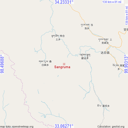
Sangruma GPS coordinates[2]
33° 39' 0" North, 99° 12' 0" East
| Map corner | latitude | longitude |
|---|---|---|
| Upper-left | 34.23331°, | 98.49688° |
| Center: | 33.65°, | 99.2° |
| Lower-right: | 33.06271°, | 99.90313° |
| Map W x H: | 130.2×130.2 km | = 80.9×80.9mi |
| max Lat: | 53.31946° ⇑31.5% North |
| Sangruma: | 33.65° |
| min Lat: | ⇓68.5% South 18.22056° |
| min Long | Sangruma | max Long |
| 75.07348° | 99.2° | 134.28917° |
| W 5%⇐ | ⇒95% E |
Elevation
Elevation of Sangruma is 4256 m = 13963 ft, and this is 3771.2 m = 12373 ft above average elevation for this country.
| Max E: |
5622 m = 18445 ft | 0.90000000000001% |
| Sangruma | 4256 m 13963 ft | |
| Avg. | 484.8 m = 1591 ft | |
Min E: |
-3 m = -10 ft | 99.1% |
See also: China elevation on elevation.city.
Geographical zone
Sangruma is located in North temperate zone (between Tropic of Cancer and the Arctic Circle). Distance of this Northern Tropic circle is 1135.6 km =705.6 mi to South.| Distance of | km | miles | from Sangruma |
|---|---|---|---|
| North Pole | 6265.5 | 3893.2 | to North |
| Arctic Circle | 3659.6 | 2274 | to North |
| Tropic Cancer | 1135.6 | 705.6 | to South |
| Equator | 3741.5 | 2324.9 | to South |


Nearby cities:
15 places around Sangruma: (largest is in red/bold)
• Changmahe
93 km =57.8 mi,  358°
358°
• Dêrnang
92.8 km =57.7 mi,  105°
105°
• Ganglong
98.5 km =61.2 mi,  82°
82°
• Jianshe
18.9 km =11.7 mi, 78°
• Jimai
43 km =26.7 mi,  74°
74°
• Kequ
73.8 km =45.9 mi,  61°
61°
• Moba
58.3 km =36.2 mi,  136°
136°
• Shang Boingor
90.7 km =56.4 mi,  156°
156°
• Shanggongma
47.7 km =29.6 mi, 64°
• Tanglag
44.8 km =27.8 mi,  30°
30°
• Tehetu
28 km =17.4 mi,  346°
346°
• Wosai
55.7 km =34.6 mi,  93°
93°
• Xia Boingor
105.3 km =65.4 mi,  153°
153°
• Xiagongma
91 km =56.5 mi, 79°
• Youyun
69.1 km =42.9 mi, 359°
Sources, notices
• [Note1] Compared only with cities in China existing in our database
• [Src1] Map data: © OpenStreetMap contributors (CC-BY-SA)
• [Src2] Other city data from geonames.org with taken over terms of usage.
• [Src3] Geographical zone / Annual Mean Temperature by Robert A. Rohde @ Wikipedia
