Moba geodata
Moba (Qinghai) is a seat of a fourth-order administrative division; located in China in Asia/Shanghai (GMT+8) time zone. In our database, there are 1268 cities with bigger population. Compared to other cities in China, 67.3% of cities are located further ↓South; 94.8% of cities are located further →East and 99.1% of cities have lower elevation than Moba. Note1


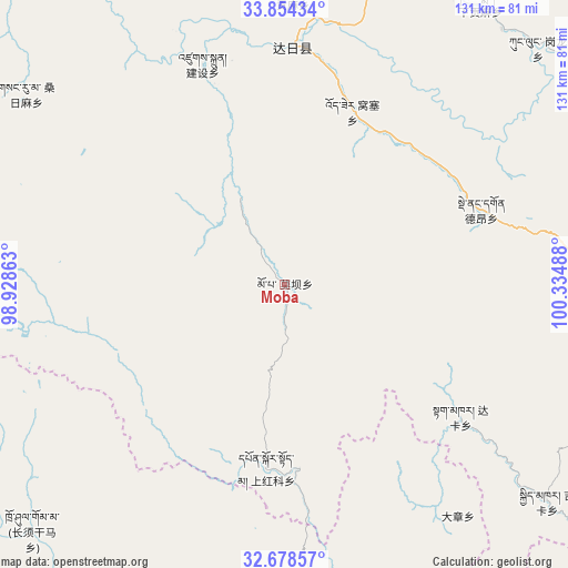
Moba GPS coordinates[2]
33° 16' 6.348" North, 99° 37' 54.3" East
| Map corner | latitude | longitude |
|---|---|---|
| Upper-left | 33.85434°, | 98.92863° |
| Center: | 33.26843°, | 99.63175° |
| Lower-right: | 32.67857°, | 100.33488° |
| Map W x H: | 130.7×130.7 km | = 81.2×81.2mi |
| max Lat: | 53.31946° ⇑32.7% North |
| Moba: | 33.26843° |
| min Lat: | ⇓67.3% South 18.22056° |
| min Long | Moba | max Long |
| 75.07348° | 99.63175° | 134.28917° |
| W 5.2%⇐ | ⇒94.8% E |
Elevation
Elevation of Moba is 4246 m = 13930 ft, and this is 3761.2 m = 12340 ft above average elevation for this country.
| Max E: |
5622 m = 18445 ft | 0.90000000000001% |
| Moba | 4246 m 13930 ft | |
| Avg. | 484.8 m = 1591 ft | |
Min E: |
-3 m = -10 ft | 99.1% |
See also: China elevation on elevation.city.
Geographical zone
Moba is located in North temperate zone (between Tropic of Cancer and the Arctic Circle). Distance of this Northern Tropic circle is 1093.2 km =679.3 mi to South.| Distance of | km | miles | from Moba |
|---|---|---|---|
| North Pole | 6308 | 3919.6 | to North |
| Arctic Circle | 3702.1 | 2300.4 | to North |
| Tropic Cancer | 1093.2 | 679.3 | to South |
| Equator | 3699.1 | 2298.5 | to South |


Nearby cities:
15 places around Moba: (largest is in red/bold)
• Dagkar
50.7 km =31.5 mi,  126°
126°
• Dêrnang
53 km =32.9 mi,  69°
69°
• Ganglong
79.8 km =49.6 mi,  46°
46°
• Gyimkar
78.5 km =48.8 mi, 129°
• Jianshe
50.9 km =31.6 mi,  335°
335°
• Jimai
53.7 km =33.4 mi,  1°
1°
• Kequ
81.8 km =50.8 mi,  17°
17°
• Markog
81.4 km =50.6 mi,  104°
104°
• Marzhing
71.5 km =44.4 mi,  87°
87°
• Sangruma
58.3 km =36.2 mi,  316°
316°
• Shang Boingor
41.2 km =25.6 mi,  186°
186°
• Shanggongma
62.9 km =39.1 mi, 2°
• Wosai
41.7 km =25.9 mi, 21°
• Xia Boingor
52.5 km =32.6 mi,  173°
173°
• Xiagongma
76.9 km =47.8 mi,  40°
40°
Sources, notices
• [Note1] Compared only with cities in China existing in our database
• [Src1] Map data: © OpenStreetMap contributors (CC-BY-SA)
• [Src2] Other city data from geonames.org with taken over terms of usage.
• [Src3] Geographical zone / Annual Mean Temperature by Robert A. Rohde @ Wikipedia
