Jiangzi geodata
Jiangzi (Tibet) is a seat of a third-order administrative division; located in China in Asia/Shanghai (GMT+8) time zone. With population of 10,000 people, there are 813 cities with bigger population in this country. Compared to other cities in China, 66.2% of cities are located further ↑North; 97.3% of cities are located further →East and 98.7% of cities have lower elevation than Jiangzi. Note1


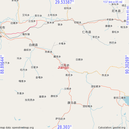
Jiangzi GPS coordinates[2]
28° 55' 12.936" North, 89° 35' 58.416" East
| Map corner | latitude | longitude |
|---|---|---|
| Upper-left | 29.53387°, | 88.89644° |
| Center: | 28.92026°, | 89.59956° |
| Lower-right: | 28.303°, | 90.30269° |
| Map W x H: | 136.9×136.9 km | = 85.1×85.1mi |
| max Lat: | 53.31946° ⇑66.2% North |
| Jiangzi: | 28.92026° |
| min Lat: | ⇓33.8% South 18.22056° |
| min Long | Jiangzi | max Long |
| 75.07348° | 89.59956° | 134.28917° |
| W 2.7%⇐ | ⇒97.3% E |
Elevation
Elevation of Jiangzi is 4036 m = 13241 ft, and this is 3551.2 m = 11651 ft above average elevation for this country.
| Max E: |
5622 m = 18445 ft | 1.3% |
| Jiangzi | 4036 m 13241 ft | |
| Avg. | 484.8 m = 1591 ft | |
Min E: |
-3 m = -10 ft | 98.7% |
See also: China elevation on elevation.city.
Geographical zone
Jiangzi is located in North temperate zone (between Tropic of Cancer and the Arctic Circle). Distance of this Northern Tropic circle is 609.7 km =378.8 mi to South.| Distance of | km | miles | from Jiangzi |
|---|---|---|---|
| North Pole | 6791.4 | 4220 | to North |
| Arctic Circle | 4185.5 | 2600.7 | to North |
| Tropic Cancer | 609.7 | 378.8 | to South |
| Equator | 3215.6 | 1998.1 | to South |


Nearby cities:
15 places around Jiangzi: (largest is in red/bold)
• Cheren
11.5 km =7.1 mi,  124°
124°
• Dazi
23 km =14.3 mi,  316°
316°
• Jangra
3.2 km =2 mi,  233°
233°
• Kangzhuo
10.7 km =6.6 mi,  250°
250°
• Kardoi
22.7 km =14.1 mi,  353°
353°
• Karmai
25.9 km =16.1 mi,  337°
337°
• Nanni
11.8 km =7.3 mi,  154°
154°
• Narong
24.8 km =15.4 mi,  3°
3°
• Niandui
6.9 km =4.3 mi, 120°
• Qiangdui
29.4 km =18.3 mi,  309°
309°
• Rasog
21.9 km =13.6 mi, 310°
• Rixing
31.7 km =19.7 mi,  266°
266°
• Zangka
11.7 km =7.3 mi, 318°
• Zhongzi
17.7 km =11 mi, 310°
• Zijin
6.4 km =4 mi, 269°
Sources, notices
• [Note1] Compared only with cities in China existing in our database
• [Src1] Map data: © OpenStreetMap contributors (CC-BY-SA)
• [Src2] Other city data from geonames.org with taken over terms of usage.
• [Src3] Geographical zone / Annual Mean Temperature by Robert A. Rohde @ Wikipedia
