Nanni geodata
Nanni (Tibet) is a seat of a fourth-order administrative division; located in China in Asia/Shanghai (GMT+8) time zone. In our database, there are 1268 cities with bigger population. Compared to other cities in China, 67% of cities are located further ↑North; 97.3% of cities are located further →East and 98.8% of cities have lower elevation than Nanni. Note1


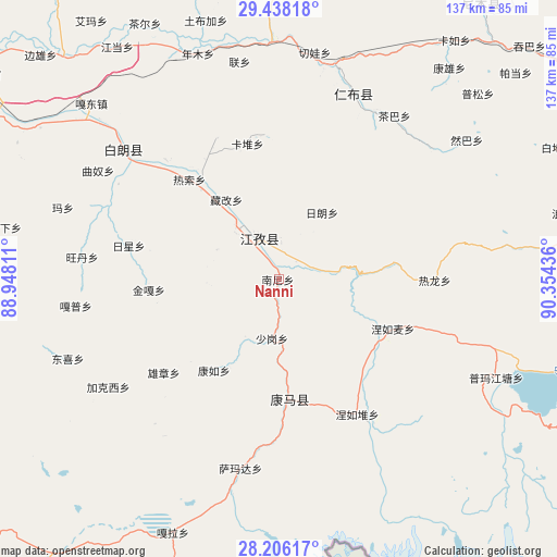
Nanni GPS coordinates[2]
28° 49' 26.4" North, 89° 39' 4.428" East
| Map corner | latitude | longitude |
|---|---|---|
| Upper-left | 29.43818°, | 88.94811° |
| Center: | 28.824°, | 89.65123° |
| Lower-right: | 28.20617°, | 90.35436° |
| Map W x H: | 137×137 km | = 85.1×85.1mi |
| max Lat: | 53.31946° ⇑67% North |
| Nanni: | 28.824° |
| min Lat: | ⇓33% South 18.22056° |
| min Long | Nanni | max Long |
| 75.07348° | 89.65123° | 134.28917° |
| W 2.7%⇐ | ⇒97.3% E |
Elevation
Elevation of Nanni is 4086 m = 13406 ft, and this is 3601.2 m = 11815 ft above average elevation for this country.
| Max E: |
5622 m = 18445 ft | 1.2% |
| Nanni | 4086 m 13406 ft | |
| Avg. | 484.8 m = 1591 ft | |
Min E: |
-3 m = -10 ft | 98.8% |
See also: China elevation on elevation.city.
Geographical zone
Nanni is located in North temperate zone (between Tropic of Cancer and the Arctic Circle). Distance of this Northern Tropic circle is 599 km =372.2 mi to South.| Distance of | km | miles | from Nanni |
|---|---|---|---|
| North Pole | 6802.1 | 4226.6 | to North |
| Arctic Circle | 4196.2 | 2607.4 | to North |
| Tropic Cancer | 599 | 372.2 | to South |
| Equator | 3204.9 | 1991.4 | to South |


Nearby cities:
15 places around Nanni: (largest is in red/bold)
• Cheren
6.2 km =3.9 mi,  46°
46°
• Dazi
34.4 km =21.4 mi,  322°
322°
• Jangra
11.6 km =7.2 mi, 319°
• Jiangzi
11.8 km =7.3 mi,  334°
334°
• Kamru
27.5 km =17.1 mi,  215°
215°
• Kangmar
29.5 km =18.3 mi,  174°
174°
• Kangzhuo
16.7 km =10.4 mi,  295°
295°
• Kardoi
34.1 km =21.2 mi,  347°
347°
• Lungmar
28.4 km =17.6 mi,  82°
82°
• Niandui
7.2 km =4.5 mi,  7°
7°
• Nierumai
30.7 km =19.1 mi,  113°
113°
• Rasog
33 km =20.5 mi, 319°
• Zangka
23.3 km =14.5 mi, 326°
• Zhongzi
28.9 km =18 mi, 319°
• Zijin
15.7 km =9.8 mi,  313°
313°
Sources, notices
• [Note1] Compared only with cities in China existing in our database
• [Src1] Map data: © OpenStreetMap contributors (CC-BY-SA)
• [Src2] Other city data from geonames.org with taken over terms of usage.
• [Src3] Geographical zone / Annual Mean Temperature by Robert A. Rohde @ Wikipedia
