Jiding geodata
Jiding (Tibet) is a seat of a third-order administrative division; located in China in Asia/Shanghai (GMT+8) time zone. In our database, there are 1268 cities with bigger population. Compared to other cities in China, 61.2% of cities are located further ↑North; 97.8% of cities are located further →East and 98.4% of cities have lower elevation than Jiding. Note1


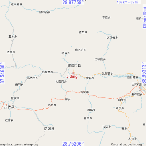
Jiding GPS coordinates[2]
29° 22' 0.012" North, 88° 15' 0" East
| Map corner | latitude | longitude |
|---|---|---|
| Upper-left | 29.97759°, | 87.54688° |
| Center: | 29.36667°, | 88.25° |
| Lower-right: | 28.75206°, | 88.95313° |
| Map W x H: | 136.3×136.3 km | = 84.7×84.7mi |
| max Lat: | 53.31946° ⇑61.2% North |
| Jiding: | 29.36667° |
| min Lat: | ⇓38.8% South 18.22056° |
| min Long | Jiding | max Long |
| 75.07348° | 88.25° | 134.28917° |
| W 2.2%⇐ | ⇒97.8% E |
Elevation
Elevation of Jiding is 3898 m = 12789 ft, and this is 3413.2 m = 11198 ft above average elevation for this country.
| Max E: |
5622 m = 18445 ft | 1.6% |
| Jiding | 3898 m 12789 ft | |
| Avg. | 484.8 m = 1591 ft | |
Min E: |
-3 m = -10 ft | 98.4% |
See also: China elevation on elevation.city.
Geographical zone
Jiding is located in North temperate zone (between Tropic of Cancer and the Arctic Circle). Distance of this Northern Tropic circle is 659.3 km =409.7 mi to South.| Distance of | km | miles | from Jiding |
|---|---|---|---|
| North Pole | 6741.8 | 4189.2 | to North |
| Arctic Circle | 4135.9 | 2569.9 | to North |
| Tropic Cancer | 659.3 | 409.7 | to South |
| Equator | 3265.3 | 2029 | to South |


Nearby cities:
15 places around Jiding: (largest is in red/bold)
• Bazha
88.7 km =55.1 mi,  103°
103°
• Bianxiong
77.8 km =48.3 mi,  93°
93°
• Dana
102.5 km =63.7 mi,  68°
68°
• Dobjoi
80.6 km =50.1 mi,  76°
76°
• Gadong
91.6 km =56.9 mi, 100°
• Jangdam
96.6 km =60 mi, 91°
• Kazi
83.5 km =51.9 mi, 73°
• Luobuqiongzi
99.5 km =61.8 mi, 102°
• Ma Xiang
93.3 km =58 mi,  117°
117°
• Namling
89.1 km =55.4 mi, 66°
• Qum
79.9 km =49.6 mi, 68°
• Quxar
65.3 km =40.6 mi,  243°
243°
• Renwu
77.7 km =48.3 mi, 70°
• Rikaze
62.8 km =39 mi, 101°
• Sajia
53.7 km =33.4 mi,  201°
201°
Sources, notices
• [Note1] Compared only with cities in China existing in our database
• [Src1] Map data: © OpenStreetMap contributors (CC-BY-SA)
• [Src2] Other city data from geonames.org with taken over terms of usage.
• [Src3] Geographical zone / Annual Mean Temperature by Robert A. Rohde @ Wikipedia
