Bor Tungge geodata
Bor Tungge (Xinjiang) is a seat of a fourth-order administrative division; located in China in Asia/Urumqi (GMT+6) time zone. In our database, there are 1268 cities with bigger population. Compared to other cities in China, 92.8% of cities are located further ↓South; 98.5% of cities are located further →East and 88.1% of cities have lower elevation than Bor Tungge. Note1


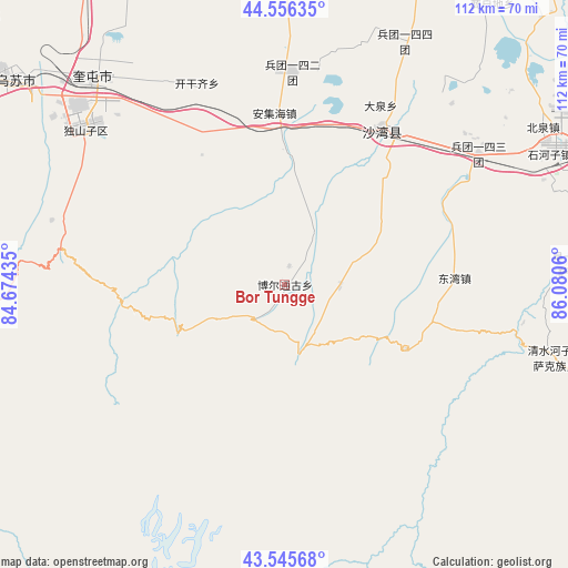
Bor Tungge GPS coordinates[2]
44° 3' 11.412" North, 85° 22' 38.892" East
| Map corner | latitude | longitude |
|---|---|---|
| Upper-left | 44.55635°, | 84.67435° |
| Center: | 44.05317°, | 85.37747° |
| Lower-right: | 43.54568°, | 86.0806° |
| Map W x H: | 112.4×112.4 km | = 69.8×69.8mi |
| max Lat: | 53.31946° ⇑7.2% North |
| Bor Tungge: | 44.05317° |
| min Lat: | ⇓92.8% South 18.22056° |
| min Long | Bor Tungge | max Long |
| 75.07348° | 85.37747° | 134.28917° |
| W 1.5%⇐ | ⇒98.5% E |
Elevation
Elevation of Bor Tungge is 1191 m = 3907 ft, and this is 706.2 m = 2317 ft above average elevation for this country.
| Max E: |
5622 m = 18445 ft | 11.9% |
| Bor Tungge | 1191 m 3907 ft | |
| Avg. | 484.8 m = 1591 ft | |
Min E: |
-3 m = -10 ft | 88.1% |
See also: China elevation on elevation.city.
Geographical zone
Bor Tungge is located in North temperate zone (between Tropic of Cancer and the Arctic Circle). Distance of this Northern Tropic circle is 2292.3 km =1424.4 mi to South.| Distance of | km | miles | from Bor Tungge |
|---|---|---|---|
| North Pole | 5108.8 | 3174.5 | to North |
| Arctic Circle | 2502.9 | 1555.2 | to North |
| Tropic Cancer | 2292.3 | 1424.4 | to South |
| Equator | 4898.3 | 3043.7 | to South |


Nearby cities:
15 places around Bor Tungge: (largest is in red/bold)
• Anjihai
33.9 km =21.1 mi,  356°
356°
• Beiquan
59.6 km =37 mi,  58°
58°
• Daquan
38 km =23.6 mi,  25°
25°
• Dongwan
34.1 km =21.2 mi,  87°
87°
• Dushanzi
52.3 km =32.5 mi,  306°
306°
• Hankazi
59.9 km =37.2 mi,  84°
84°
• Huochezhan
54.7 km =34 mi,  315°
315°
• Jingouhe
37.9 km =23.5 mi,  40°
40°
• Kaiganqi
43.5 km =27 mi,  340°
340°
• Kuytun
56.3 km =35 mi, 317°
• Sandaohezi
36 km =22.4 mi, 32°
• Shanghudi
66.3 km =41.2 mi, 36°
• Shihezi
59.4 km =36.9 mi, 62°
• Ulan Us
46.4 km =28.8 mi, 55°
• Xigebi
11.2 km =7 mi, 89°
Sources, notices
• [Note1] Compared only with cities in China existing in our database
• [Src1] Map data: © OpenStreetMap contributors (CC-BY-SA)
• [Src2] Other city data from geonames.org with taken over terms of usage.
• [Src3] Geographical zone / Annual Mean Temperature by Robert A. Rohde @ Wikipedia
