Huanglian geodata
Huanglian (Guizhou) is a seat of a fourth-order administrative division; located in China in Asia/Shanghai (GMT+8) time zone. In our database, there are 1268 cities with bigger population. Compared to other cities in China, 69.8% of cities are located further ↑North; 83.7% of cities are located further →East and 92.7% of cities have lower elevation than Huanglian. Note1


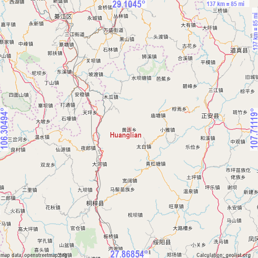
Huanglian GPS coordinates[2]
28° 29' 17.988" North, 107° 0' 29.016" East
| Map corner | latitude | longitude |
|---|---|---|
| Upper-left | 29.1045°, | 106.30494° |
| Center: | 28.48833°, | 107.00806° |
| Lower-right: | 27.86854°, | 107.71119° |
| Map W x H: | 137.4×137.4 km | = 85.4×85.4mi |
| max Lat: | 53.31946° ⇑69.8% North |
| Huanglian: | 28.48833° |
| min Lat: | ⇓30.2% South 18.22056° |
| min Long | Huanglian | max Long |
| 75.07348° | 107.00806° | 134.28917° |
| W 16.3%⇐ | ⇒83.7% E |
Elevation
Elevation of Huanglian is 1672 m = 5486 ft, and this is 1187.2 m = 3895 ft above average elevation for this country.
| Max E: |
5622 m = 18445 ft | 7.3% |
| Huanglian | 1672 m 5486 ft | |
| Avg. | 484.8 m = 1591 ft | |
Min E: |
-3 m = -10 ft | 92.7% |
See also: China elevation on elevation.city.
Geographical zone
Huanglian is located in North temperate zone (between Tropic of Cancer and the Arctic Circle). Distance of this Northern Tropic circle is 561.7 km =349 mi to South.| Distance of | km | miles | from Huanglian |
|---|---|---|---|
| North Pole | 6839.5 | 4249.9 | to North |
| Arctic Circle | 4233.6 | 2630.6 | to North |
| Tropic Cancer | 561.7 | 349 | to South |
| Equator | 3167.6 | 1968.3 | to South |


Nearby cities:
15 places around Huanglian: (largest is in red/bold)
• Anwen
32.5 km =20.2 mi,  310°
310°
• Bajiao
32.8 km =20.4 mi,  33°
33°
• Chumi
33.1 km =20.6 mi,  211°
211°
• Dahe
24.8 km =15.4 mi,  222°
222°
• Huangyang
22.3 km =13.9 mi,  162°
162°
• Miaotang
17.5 km =10.9 mi,  63°
63°
• Podu
34.5 km =21.4 mi,  329°
329°
• Ruixi
34.8 km =21.6 mi,  74°
74°
• Shuibatang
28.4 km =17.6 mi,  13°
13°
• Songkan
16 km =9.9 mi,  295°
295°
• Taibai
11.8 km =7.3 mi,  138°
138°
• Xiaoya
20.5 km =12.7 mi,  89°
89°
• Xinzhan
18.5 km =11.5 mi,  233°
233°
• Yangdeng
25.9 km =16.1 mi,  349°
349°
• Yelang
24.3 km =15.1 mi,  246°
246°
Sources, notices
• [Note1] Compared only with cities in China existing in our database
• [Src1] Map data: © OpenStreetMap contributors (CC-BY-SA)
• [Src2] Other city data from geonames.org with taken over terms of usage.
• [Src3] Geographical zone / Annual Mean Temperature by Robert A. Rohde @ Wikipedia
