Dahe geodata
Dahe (Guizhou) is a seat of a fourth-order administrative division; located in China in Asia/Shanghai (GMT+8) time zone. In our database, there are 1268 cities with bigger population. Compared to other cities in China, 71.2% of cities are located further ↑North; 84.1% of cities are located further →East and 83.8% of cities have lower elevation than Dahe. Note1


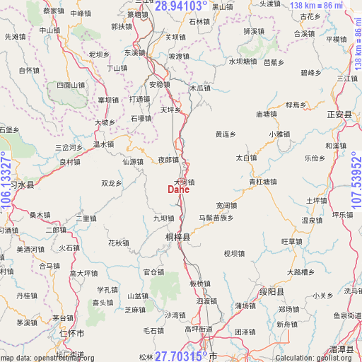
Dahe GPS coordinates[2]
28° 19' 26.004" North, 106° 50' 11.004" East
| Map corner | latitude | longitude |
|---|---|---|
| Upper-left | 28.94103°, | 106.13327° |
| Center: | 28.32389°, | 106.83639° |
| Lower-right: | 27.70315°, | 107.53952° |
| Map W x H: | 137.6×137.6 km | = 85.5×85.5mi |
| max Lat: | 53.31946° ⇑71.2% North |
| Dahe: | 28.32389° |
| min Lat: | ⇓28.8% South 18.22056° |
| min Long | Dahe | max Long |
| 75.07348° | 106.83639° | 134.28917° |
| W 15.9%⇐ | ⇒84.1% E |
Elevation
Elevation of Dahe is 909 m = 2982 ft, and this is 424.2 m = 1392 ft above average elevation for this country.
| Max E: |
5622 m = 18445 ft | 16.2% |
| Dahe | 909 m 2982 ft | |
| Avg. | 484.8 m = 1591 ft | |
Min E: |
-3 m = -10 ft | 83.8% |
See also: China elevation on elevation.city.
Geographical zone
Dahe is located in North temperate zone (between Tropic of Cancer and the Arctic Circle). Distance of this Northern Tropic circle is 543.4 km =337.7 mi to South.| Distance of | km | miles | from Dahe |
|---|---|---|---|
| North Pole | 6857.7 | 4261.2 | to North |
| Arctic Circle | 4251.9 | 2642 | to North |
| Tropic Cancer | 543.4 | 337.7 | to South |
| Equator | 3149.3 | 1956.9 | to South |


Nearby cities:
15 places around Dahe: (largest is in red/bold)
• Chumi
10 km =6.2 mi,  182°
182°
• Guancang
34.2 km =21.3 mi,  200°
200°
• Guandian
22.3 km =13.9 mi,  261°
261°
• Huanglian
24.8 km =15.4 mi,  42°
42°
• Huangyang
23.5 km =14.6 mi,  97°
97°
• Huaqiu
32.5 km =20.2 mi,  224°
224°
• Jianba
33.8 km =21 mi,  143°
143°
• Liziba
15.8 km =9.8 mi,  207°
207°
• Loushanguan
20.9 km =13 mi, 183°
• Songkan
25.2 km =15.7 mi,  5°
5°
• Taibai
26.3 km =16.3 mi,  69°
69°
• Wenshui
33.4 km =20.8 mi,  294°
294°
• Xianyuan
24.1 km =15 mi, 285°
• Xinzhan
7.4 km =4.6 mi,  15°
15°
• Yelang
10.3 km =6.4 mi,  327°
327°
Sources, notices
• [Note1] Compared only with cities in China existing in our database
• [Src1] Map data: © OpenStreetMap contributors (CC-BY-SA)
• [Src2] Other city data from geonames.org with taken over terms of usage.
• [Src3] Geographical zone / Annual Mean Temperature by Robert A. Rohde @ Wikipedia
