Yangdeng geodata
Yangdeng (Guizhou) is a seat of a fourth-order administrative division; located in China in Asia/Shanghai (GMT+8) time zone. With population of 474 people, there are 1264 cities with bigger population in this country. Compared to other cities in China, 67.7% of cities are located further ↑North; 83.8% of cities are located further →East and 75.7% of cities have lower elevation than Yangdeng. Note1


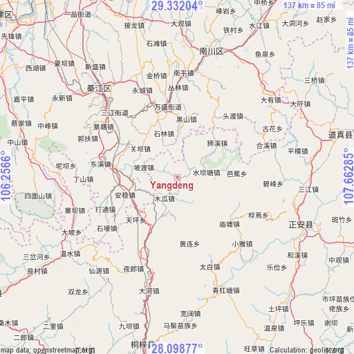
Yangdeng GPS coordinates[2]
28° 43' 1.992" North, 106° 57' 34.992" East
| Map corner | latitude | longitude |
|---|---|---|
| Upper-left | 29.33204°, | 106.2566° |
| Center: | 28.71722°, | 106.95972° |
| Lower-right: | 28.09877°, | 107.66285° |
| Map W x H: | 137.1×137.1 km | = 85.2×85.2mi |
| max Lat: | 53.31946° ⇑67.7% North |
| Yangdeng: | 28.71722° |
| min Lat: | ⇓32.3% South 18.22056° |
| min Long | Yangdeng | max Long |
| 75.07348° | 106.95972° | 134.28917° |
| W 16.2%⇐ | ⇒83.8% E |
Elevation
Elevation of Yangdeng is 539 m = 1768 ft, and this is 54.2 m = 178 ft above average elevation for this country.
| Max E: |
5622 m = 18445 ft | 24.3% |
| Yangdeng | 539 m 1768 ft | |
| Avg. | 484.8 m = 1591 ft | |
Min E: |
-3 m = -10 ft | 75.7% |
See also: China elevation on elevation.city.
Geographical zone
Yangdeng is located in North temperate zone (between Tropic of Cancer and the Arctic Circle). Distance of this Northern Tropic circle is 587.1 km =364.8 mi to South.| Distance of | km | miles | from Yangdeng |
|---|---|---|---|
| North Pole | 6814 | 4234 | to North |
| Arctic Circle | 4208.1 | 2614.8 | to North |
| Tropic Cancer | 587.1 | 364.8 | to South |
| Equator | 3193.1 | 1984.1 | to South |


Nearby cities:
15 places around Yangdeng: (largest is in red/bold)
• Anwen
20.2 km =12.6 mi,  258°
258°
• Bajiao
23 km =14.3 mi,  85°
85°
• Ganshui
24.4 km =15.2 mi,  276°
276°
• Guanba
17.7 km =11 mi,  302°
302°
• Huanglian
25.9 km =16.1 mi,  169°
169°
• Jinshan
27.6 km =17.1 mi,  30°
30°
• Miaotang
26.9 km =16.7 mi,  130°
130°
• Nantong
25.1 km =15.6 mi,  339°
339°
• Podu
13.7 km =8.5 mi,  287°
287°
• Puhechang
29 km =18 mi,  334°
334°
• Shilin
18.6 km =11.6 mi, 342°
• Shixi
20.5 km =12.7 mi,  48°
48°
• Shuibatang
11.4 km =7.1 mi,  79°
79°
• Songkan
21 km =13 mi,  207°
207°
• Wansheng
27.5 km =17.1 mi,  353°
353°
Sources, notices
• [Note1] Compared only with cities in China existing in our database
• [Src1] Map data: © OpenStreetMap contributors (CC-BY-SA)
• [Src2] Other city data from geonames.org with taken over terms of usage.
• [Src3] Geographical zone / Annual Mean Temperature by Robert A. Rohde @ Wikipedia
