Villapinzón geodata
Villapinzón (Cundinamarca) is a seat of a second-order administrative division; located in Colombia in America/Bogota (GMT-5) time zone. With population of 5,874 people, there are 457 cities with bigger population in this country. Compared to other cities in Colombia, 57% of cities are located further ↑North; 73.7% of cities are located further ←West and 96.2% of cities have lower elevation than Villapinzón. Note1


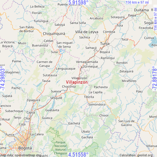
Villapinzón GPS coordinates[2]
5° 12' 58.212" North, 73° 35' 41.64" West
| Map corner | latitude | longitude |
|---|---|---|
| Upper-left | 5.91598°, | -74.29803° |
| Center: | 5.21617°, | -73.5949° |
| Lower-right: | 4.51558°, | -72.89178° |
| Map W x H: | 155.7×155.7 km | = 96.7×96.7mi |
| max Lat: | 13.38166° ⇑57% North |
| Villapinzón: | 5.21617° |
| min Lat: | ⇓43% South -4.21528° |
| min Long | Villapinzón | max Long |
| -81.70636° | -73.5949° | -67.06996° |
| W 73.7%⇐ | ⇒26.3% E |
Elevation
Elevation of Villapinzón is 2728 m = 8950 ft, and this is 1578.7 m = 5179 ft above average elevation for this country.
| Max E: |
3342 m = 10965 ft | 3.8% |
| Villapinzón | 2728 m 8950 ft | |
| Avg. | 1149.3 m = 3771 ft | |
Min E: |
1 m = 3 ft | 96.2% |
See also: Colombia elevation on elevation.city.
Geographical zone
Villapinzón is located in North Torrid zone (between Equator and Tropic of Cancer). Distance of Equator is 580 km =360.4 mi to South.| Distance of | km | miles | from Villapinzón |
|---|---|---|---|
| North Pole | 9427.1 | 5857.7 | to North |
| Arctic Circle | 6821.2 | 4238.5 | to North |
| Tropic Cancer | 2025.9 | 1258.8 | to North |
| Equator | 580 | 360.4 | to South |


Nearby cities:
15 places around Villapinzón: (largest is in red/bold)
• Chocontá
12.8 km =8 mi,  231°
231°
• Cucunubá
19.3 km =12 mi,  281°
281°
• Guachetá
21.2 km =13.2 mi,  331°
331°
• La Capilla
21.4 km =13.3 mi,  128°
128°
• Lenguazaque
16.4 km =10.2 mi,  308°
308°
• Machetá
15 km =9.3 mi,  185°
185°
• Manta
23.8 km =14.8 mi,  165°
165°
• Nuevo Colón
21.6 km =13.4 mi,  45°
45°
• Pachavita
23.5 km =14.6 mi,  111°
111°
• Tenza
24.7 km =15.3 mi, 128°
• Tibaná
24.7 km =15.3 mi,  62°
62°
• Tibirita
20.8 km =12.9 mi,  151°
151°
• Turmequé
16.6 km =10.3 mi,  44°
44°
• Ventaquemada
18.7 km =11.6 mi,  26°
26°
• Úmbita
15.3 km =9.5 mi,  88°
88°
Sources, notices
• [Note1] Compared only with cities in Colombia existing in our database
• [Src1] Map data: © OpenStreetMap contributors (CC-BY-SA)
• [Src2] Other city data from geonames.org with taken over terms of usage.
• [Src3] Geographical zone / Annual Mean Temperature by Robert A. Rohde @ Wikipedia
